Great Ocean Walk
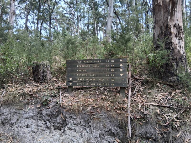
The Great Ocean Walk is a 110km one-way, long-distance trail through the Great Otway National Patk coastline, that can be done using companies that offer drop-offs, bed and breakfasts, lunch packages and dinners along the route (high prices) or by hike-in campsites. We did the latter as in this way you embrace nature. Off course you need some preparation, as you will not encounter shops or villages, so look at websites to make sure you have all material necessary for long hiking distances, including good backpacks. We bought a lightweight tent and still had about 30kgs of material in the backpacks. You can do this in 5 days if you walk fast or take advantage of the campsites (about each 15kms) and do it at slow pace, enjoying sceneries, swims, animals ... We did it over 8 days as we enjoy the breaks and like to have time for just looking at the amazing nature, taking time for lunches, doing nothing, try photo shoots, a bit of reading, and also enjoying the lovely campsites and each other. Many options. Starting point is Apollo Bay, endpoint are the 12 Apostles. Many maps and details are found online, but it is worthwhile buying (or ordering) a small book that can be purchased at the Apollo Bay visitor centre, as it shows you all maps, side trails, and much more. You can also buy online if you want to use it for preparation:
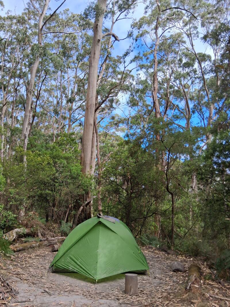
Hike-in campsites need to be booked in advance on the Parks Victoria booking page, and cost you less than 20 Euro per day. Easy to do here: https://bookings.parks.vic.gov.au/great-ocean-walk?_gl=1*w5h81t*_gcl_au*MjIzNDc0NjA4LjE3NzUyMDAwNzc.*_ga*ODU4NTU1OTM5LjE3NzUyMDAwNzg.*_ga_D5X5YJ8TTE*czE3NzUyMDAwNzckbzEkZzEkdDE3NzUyMDE3NjAkajMzJGwwJGgw#/accom/33304.
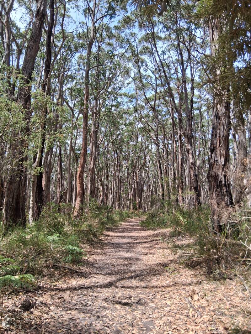
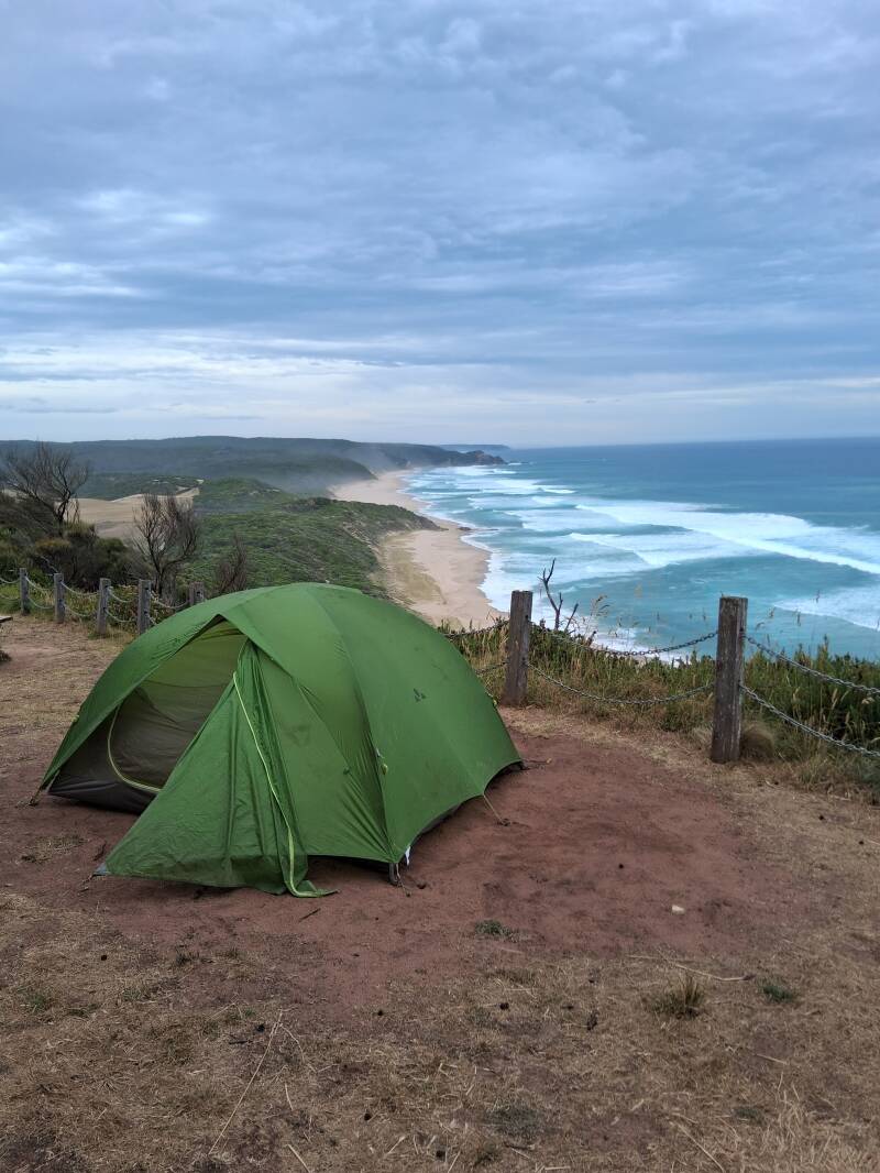
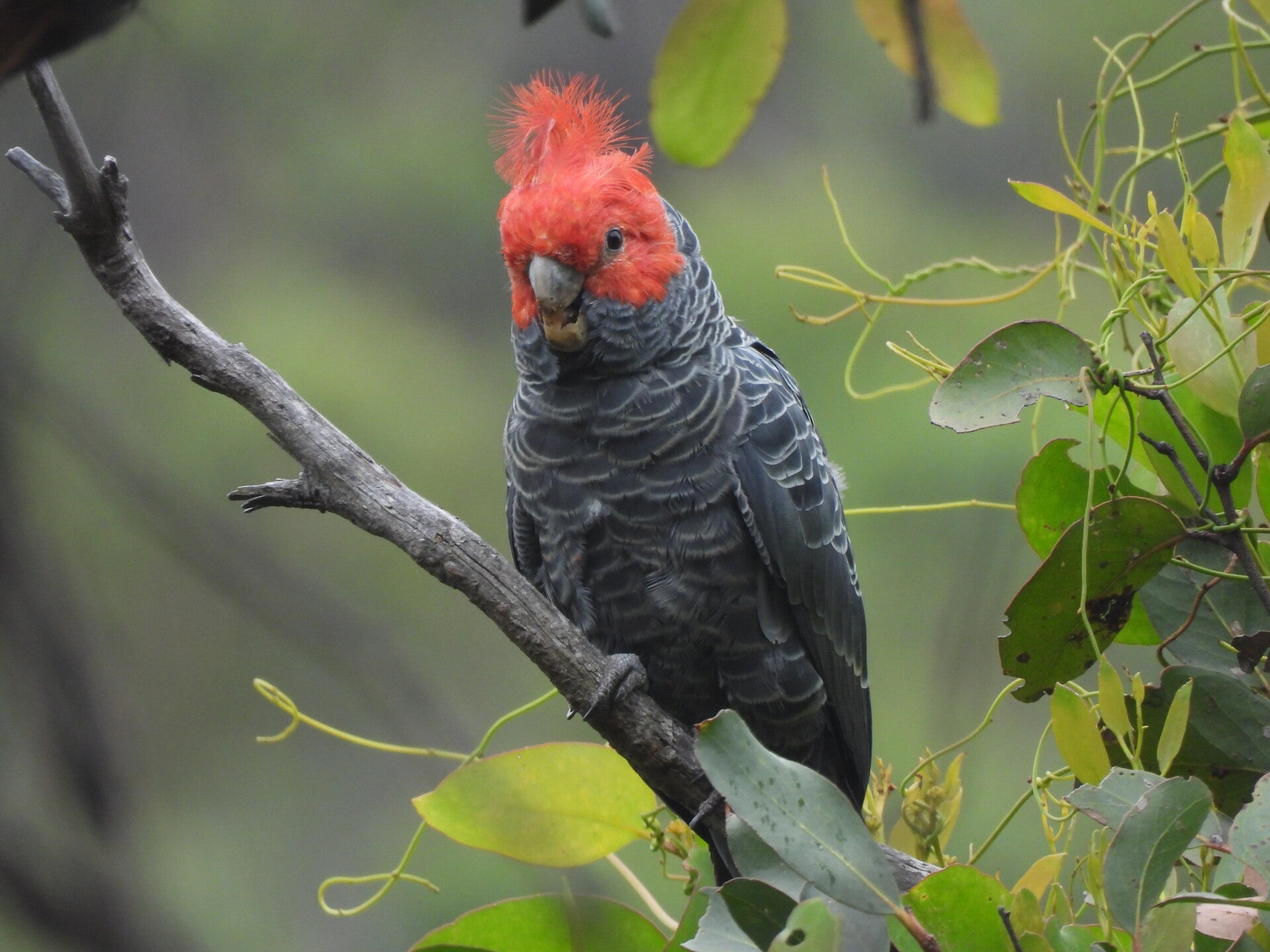
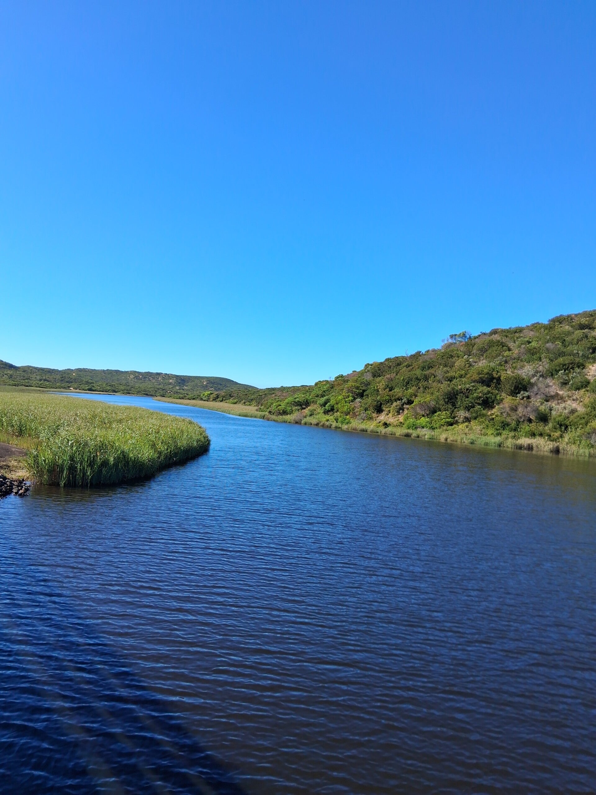
The campsites are stunning! Very well maintained, with a shelter, water in tanks, and nicely separated camping spots, at some place with really impressive views on the coastline. No electricity off course, so bring power banks. For food, we bought a gas canister and dried products (pasta with sauce mainly), bread, cookies, tortilla wraps ... in Apollo Bay, and off course we took water filter bottles with us. This was the first time we did this long hike, but it was worth it and not that difficult at all. We had 1 food and clothes exchange (and garbage removal) halfway, as the Great Ocean Road is sometimes nearby. There are some persons that offer this service. Lee Bryant was one of them, and you will fine his details online. What you will see during the trail is great, from tall eucalypt forests, coastal heathlands, deserted beaches, rocky shore platforms, creeks, rivers, cliff-tops, panoramic views, and off course animals (kangaroos, wallabies, koalas, snakes, lizards, echidna, and whatever you encounter). So ... do it!
Some preparation and a bit of relaxing in Apollo Bay
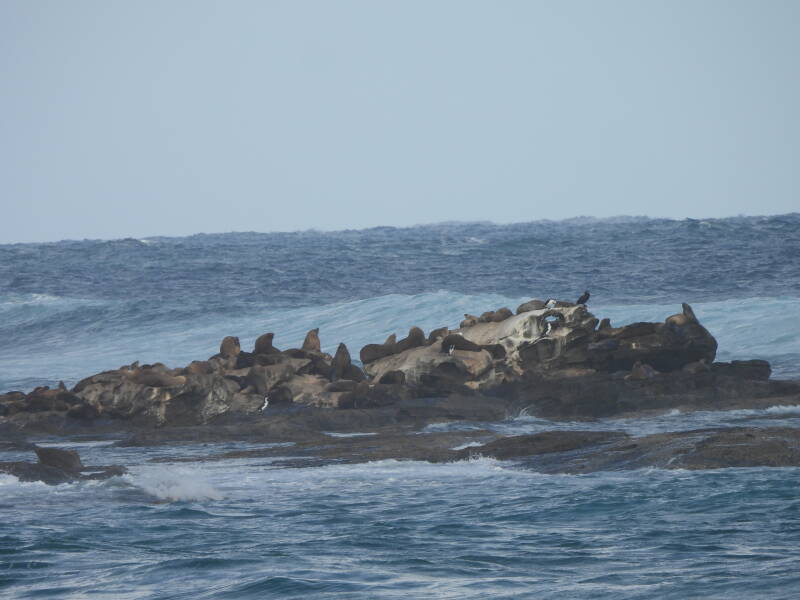
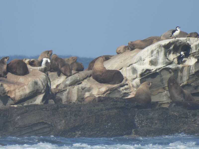
We came from Sydney so took a flight to Melbourne the evening before and slept at an airport motel, and then headed towards Apollo Bay, what takes you around 5 hours. A good website to figure out transport is www.rometorio.com. Anyhow, you will need to take the V-line bus in Geelong Station/Railway Terrace. Make sure to book this one, either at Geelong Station or online. There are only a few buses per day. From Melbourne airport, there are shuttles to Southern Cross station in Melbourne and from there you can take a train to Geelong Station and take the V-bus. The V-line bus brings you over the coastal road to the Apollo Bay Visitor Center. We booked a motel in Apollo Bay in advance, put our luggage there and then went shopping to buy everything we needed to start the trail the day after. There are some small supermarkets on the street next to the beach for buying all you need. Gas canisters are off course the main item and if not buying it at Melbourne or Geelong you need to find it here … WildDog Hardware was the proposed option but they had plenty of BBQ material but no gas canisters, but you can find them at a small shop in Pascoe Street close to the corner with Moore Street. Essential material indeed, so if possible bring it so you are not in need to search for it here… the pot holder we brought from home. In the late afternoon, satisfied with the bought material, we went to Marengo by foot (in fact this is the first part of the trail, but we had time so why not?) to watch the seal colony. Easy to overlook and even people on the beach did not spot it, so you need a camera with good lens to see them, but there is a small rocky island in front of Marengo campsite with dozens of seals. Further that evening, had a final nice dinner at the terrace of Apollo Bay Hotel before getting a rest.

Day 1. Apollo Bay to Shelley Beach, ending at Elliot Ridge Campsite
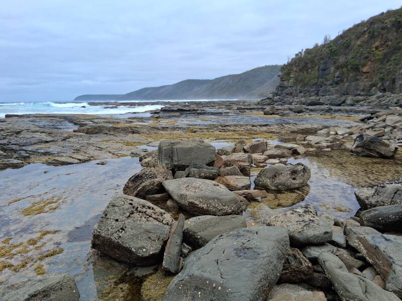
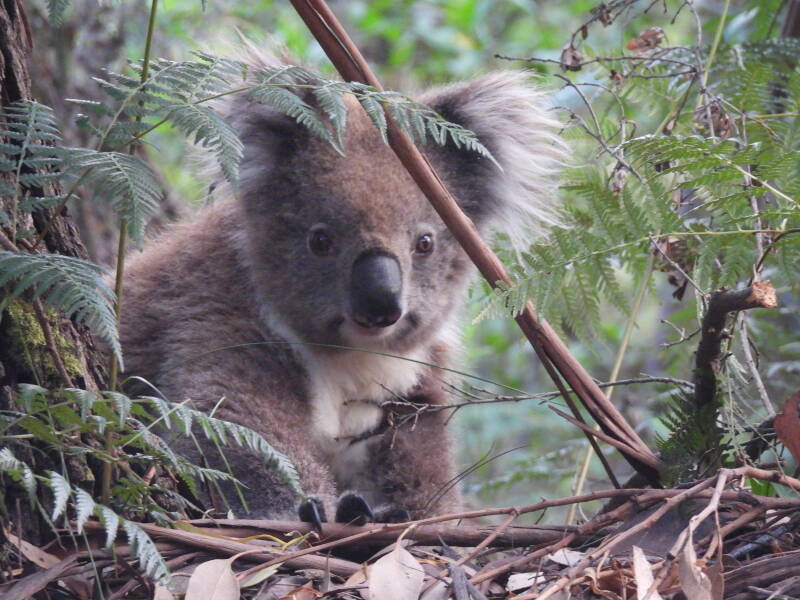
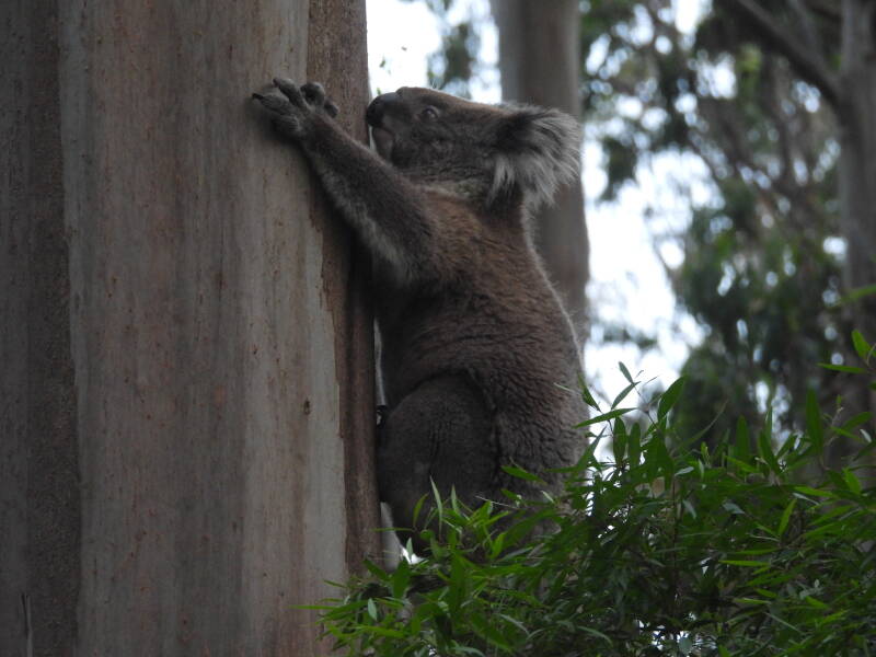
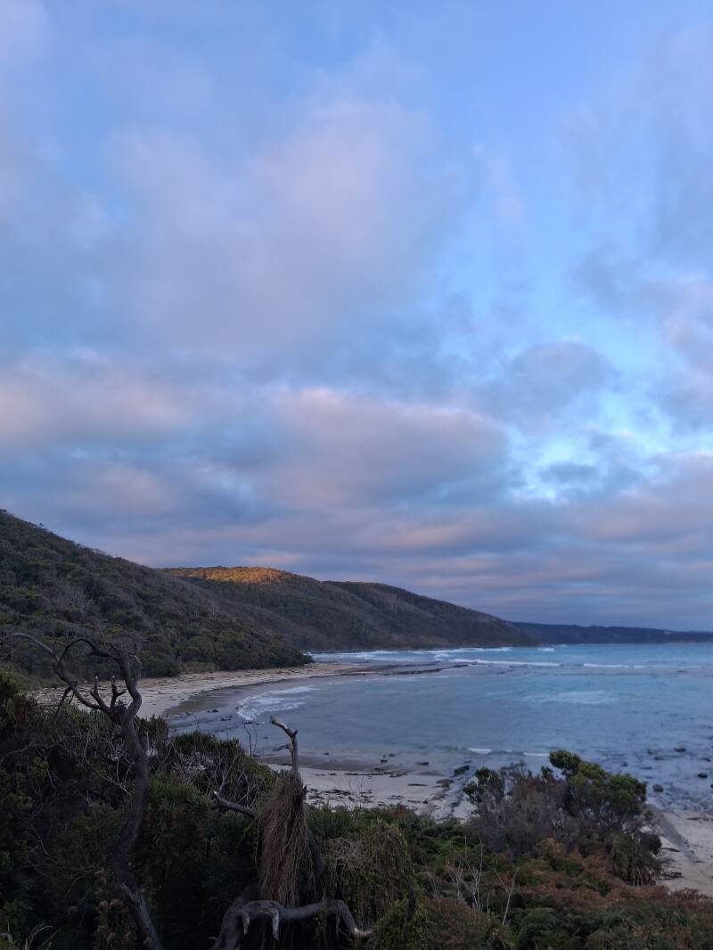
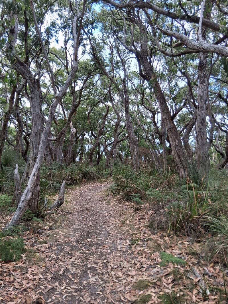
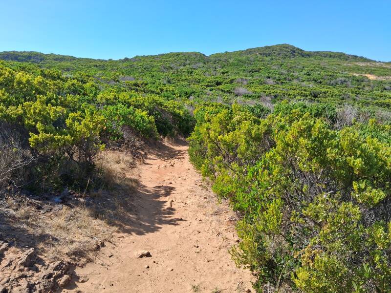
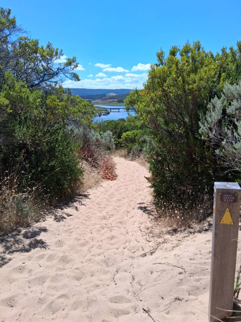
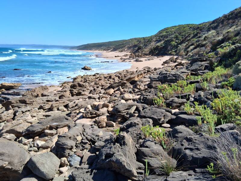
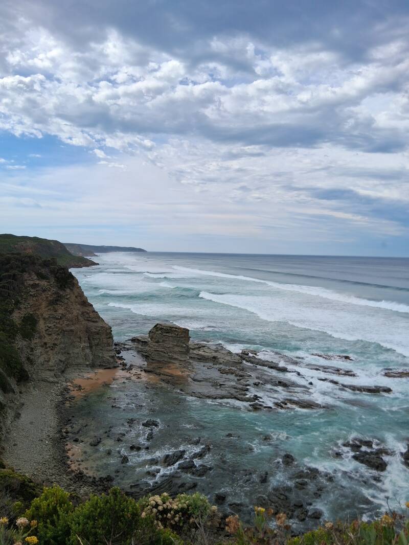
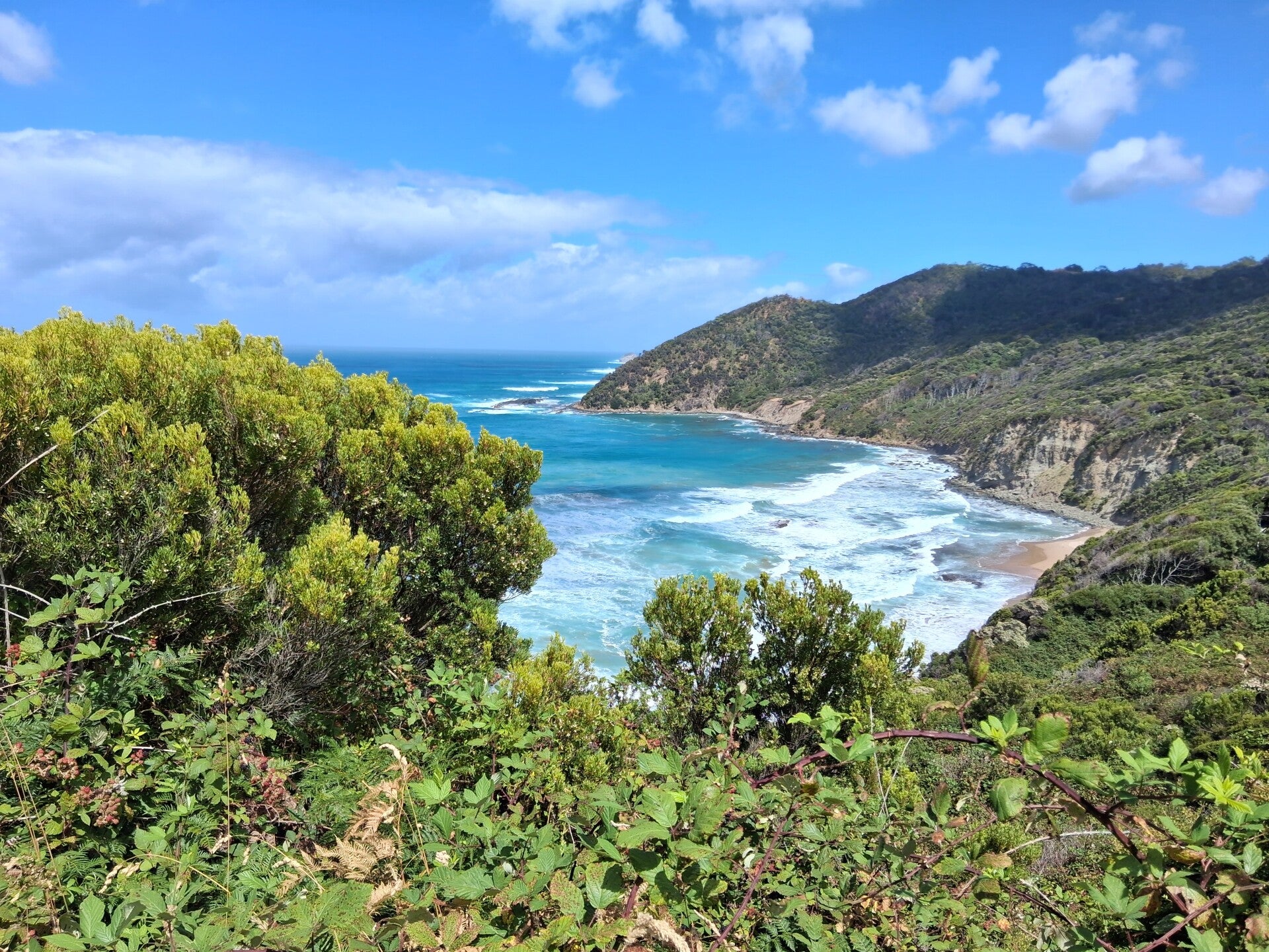
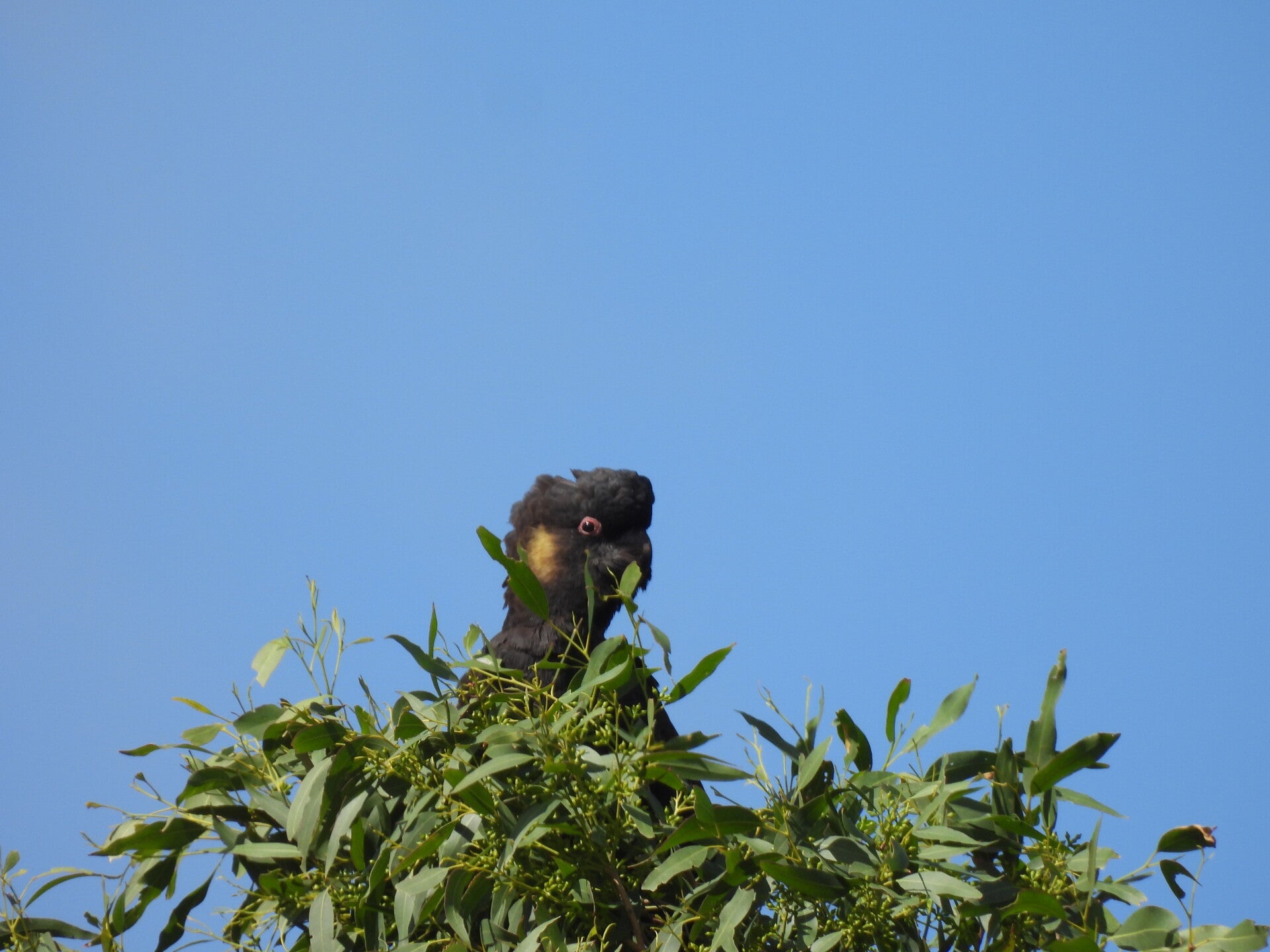
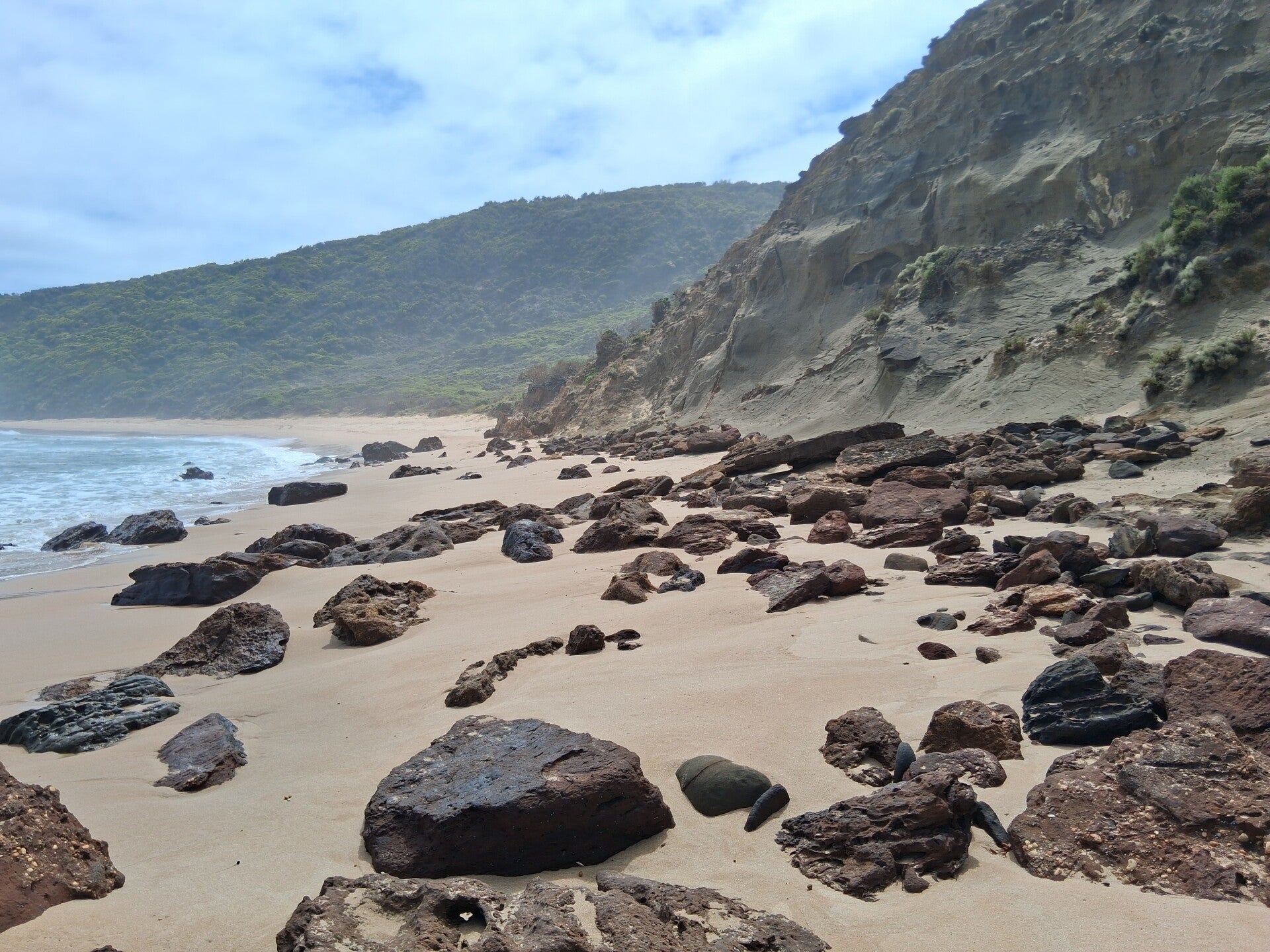
The walk’s official starting place is at a sign by the Visitor Centre in Apollo Bay and goes to Marengo Caravan Park, where you can see Australian fur seals on the rocks in the sea, and then either follows beaches and rock platforms, or the inland trail. There are marks (decision points) on the whole Ocean Walk to let you decide which way to take. This can depend on tides on some occasions. We downloaded an app (Tides Australia) to get a view on tides, but apart from some minor parts where we climbed over rocks we never had issues, except on Wreck Beach (see below). We followed the beach track to Shelly Beach, which is a small beach (compared to what follows ...). This walk mostly goes over rocky beaches, small sandy parts, and then, after Shelly beach, climbs into forest, crosses Eliott River and goes on a steep path to the first campsite, Elliot Ridge GOW campsite, through eucalyptus forest. Here you will always find koalas when you know where to look at. High in the treetops, or on the tree trunks, you will find grey blobs that are mostly eating or sleeping, so immobile, but these are the ones you are looking for ... We had the chance of encountering one just before our tent while crossing the campsite from 1 tree to another. If looking at Google maps, you will fine some circular smaller trails starting from the campsite. Elliott Road is one of these. Multiple koalas again... The campsite is in the middle of the forest, and the only place where the filtered drinking water was greenish and had a bit of ‘taste’ because of the leaves that fell on the roof of the shelter that collects the rain water. But the campsite was perfect, with noises of fighting koalas (yes...) in the night. The walk is around 10kms so quit easy. Some people immediately go to Blanket Bay, another 12 kms further, but as we did some loops here we placed our tent in Elliot Ridge GOW campsite. Take your time!
Day 2. From Shelley Beach to Blanket Bay
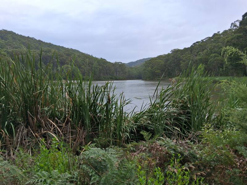
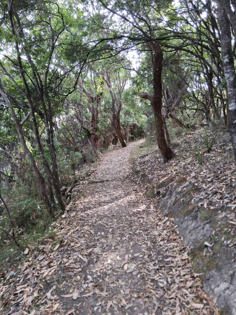
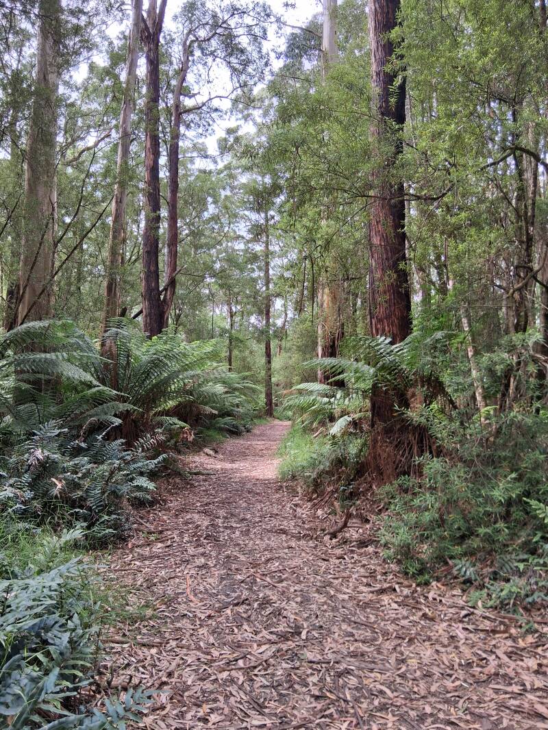
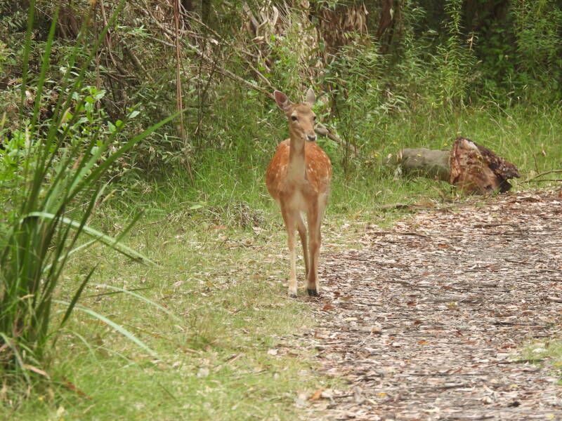
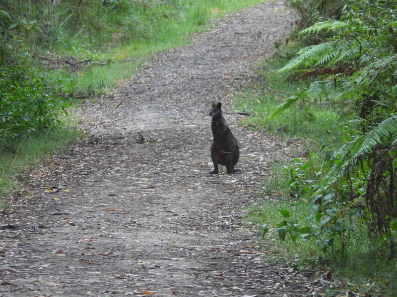
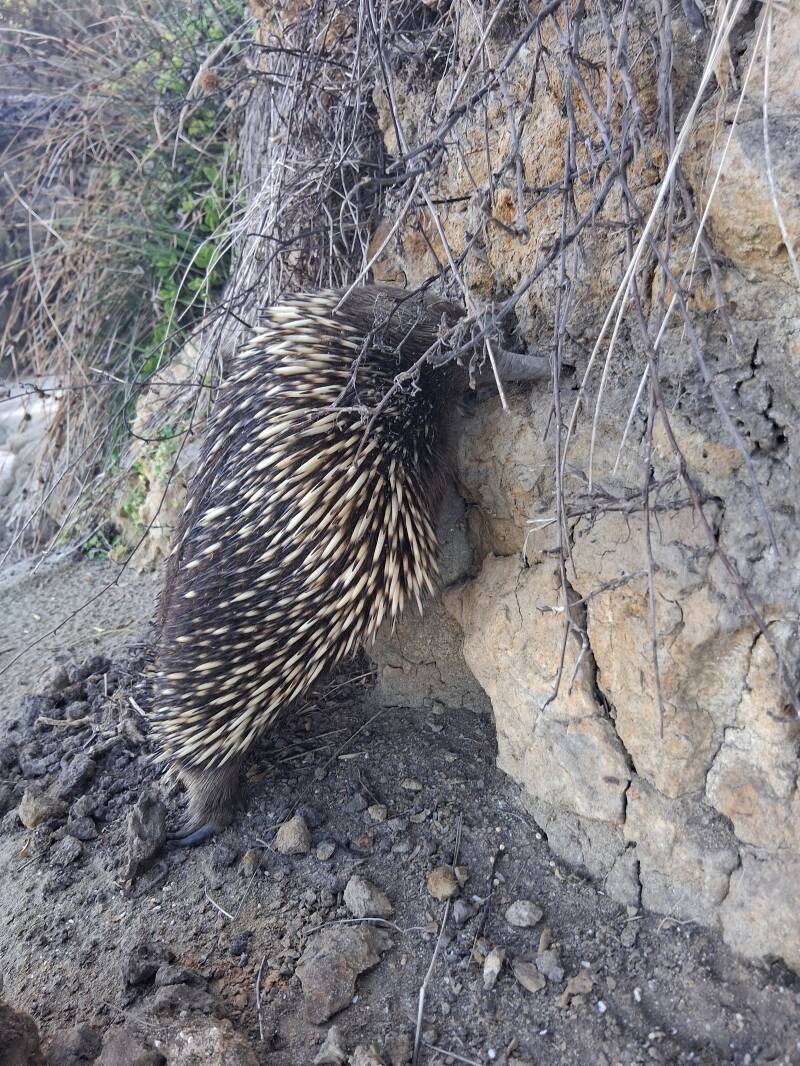
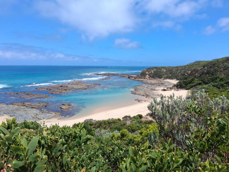
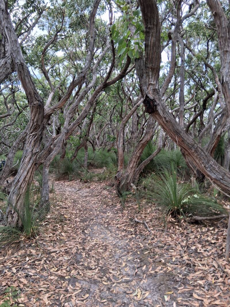
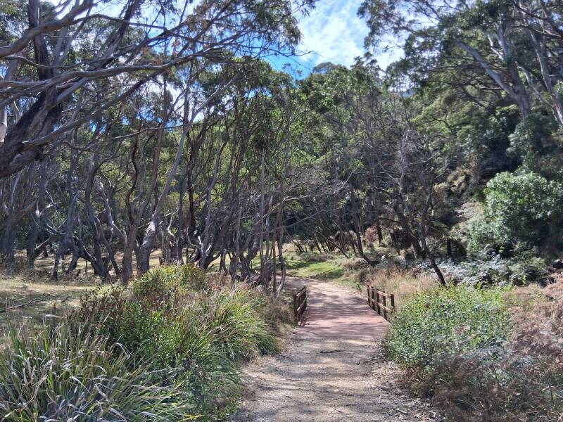
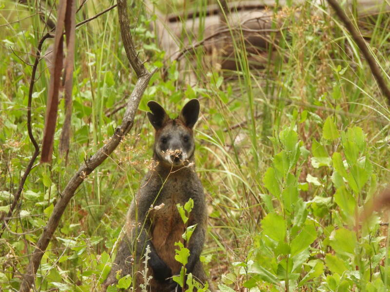
The second day was a day of forest, as the trail brings you away from the coastline into the rainforest, with big eucalyptus trees and tree ferns, following a mostly broad walking track, so different than the tracks on all other days. Around 10 kms so plenty of time, also to enjoy Blanket Bay after arriving at the Blanket Bay campsite. We spotted black wallabies and a deer on our way. The former are much more anxious than kangaroos and some immediately jump into the forest when they see you, so keep silent and look around. After heading north, away from the coastline, you meander down again to Blanket Bay. Here you can walk quite a distance along the beach, and the water is calm so there is a possibility to go into the water here, but be aware of rocks and tides. We also met an echidna digging at the rocks, looking for ants. The campground is the most busy one we encountered as also there is a bigger one that can host locals that bring their camper, and go out for a short break.
Day 3. Blanket Bay to Cape Otway
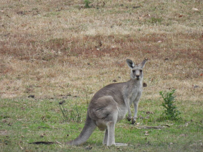
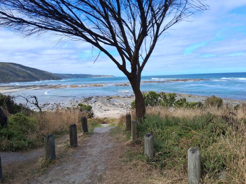
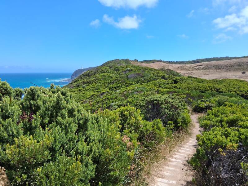
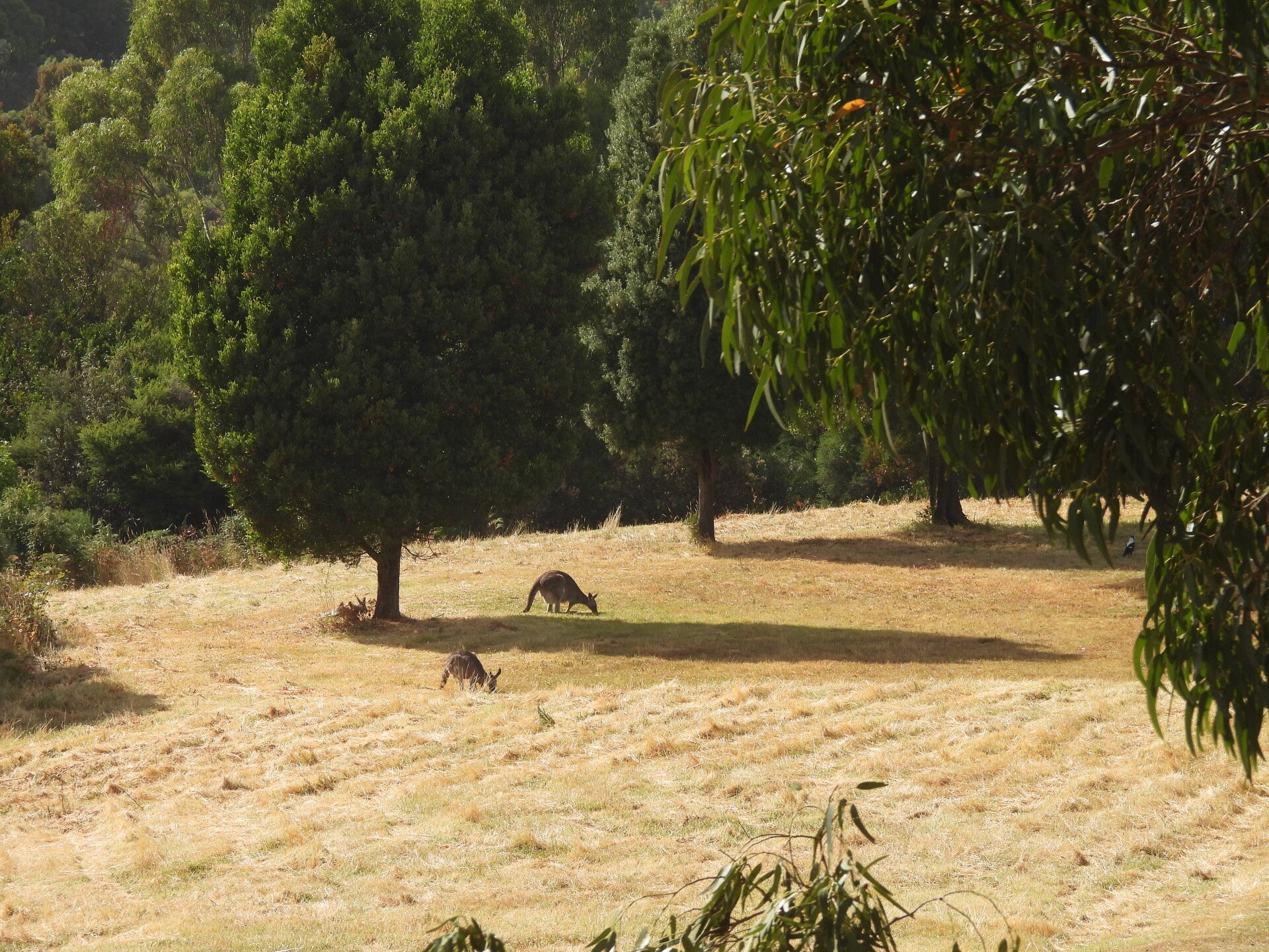
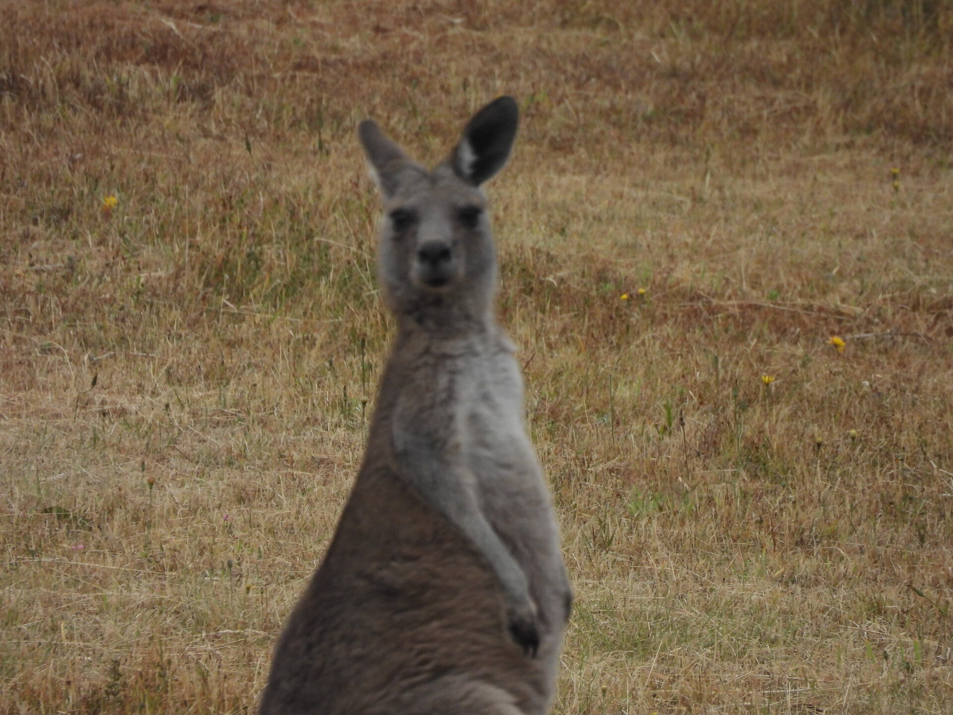
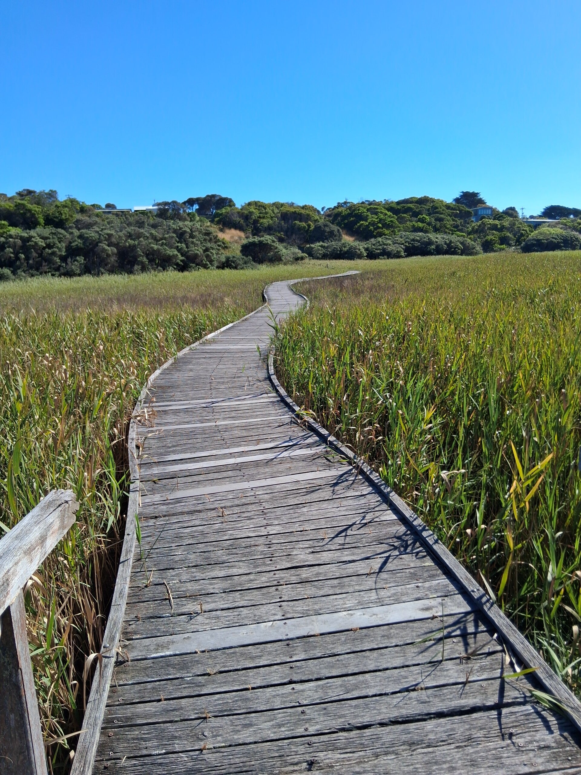
This day is full of nice boardwalks and amazing views over the ocean, over small river bridges towards Point Lewis Lookout. Then it goes down to Parker inlet, a small ocean inlet where the ocean bumps against the rocks, ideal for a lunchbreak. After Parker inlet, you go steep uphill (first snake encounter, although a small one) in eucalyptus forest, followed by great views over the Ocean. Then you pass places where we could go into the ocean, such as Crayfish Bay, and you can see the Cape Otway lighthouse becoming bigger and bigger. Parrots in all colours, koalas, ... so keep an eye on the trees and listen to the noises. Also kangaroos in the grasslands closer to the Lighthouse. We did not visit the lighthouse (but bought ice cream in the shop) but went through towards the hike-in campground, where others saw large snakes drinking in the mud on the water tank. Nice walk of a bit more than 10kms. If you still have energy and are in need of some food or drinks, look at Google Maps and walk to Bimbi Park, a campsite with caravans and a shop. It is about 2 kms from the hike-in campground through grassland, and you can sit there and relax.
Day 4. Cape Otway to Aire River
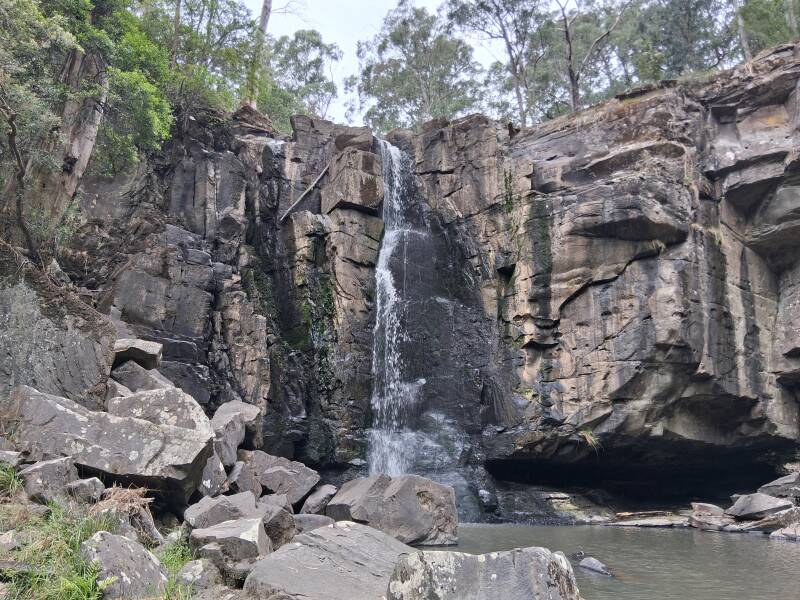
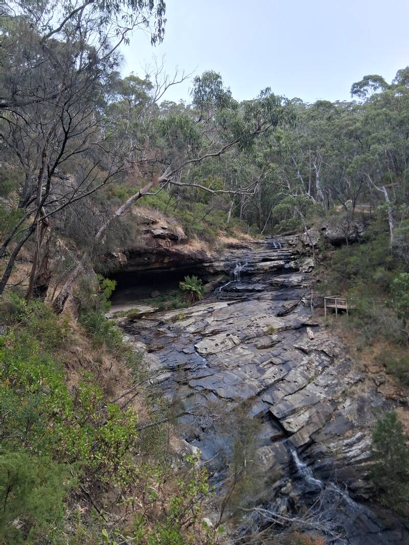
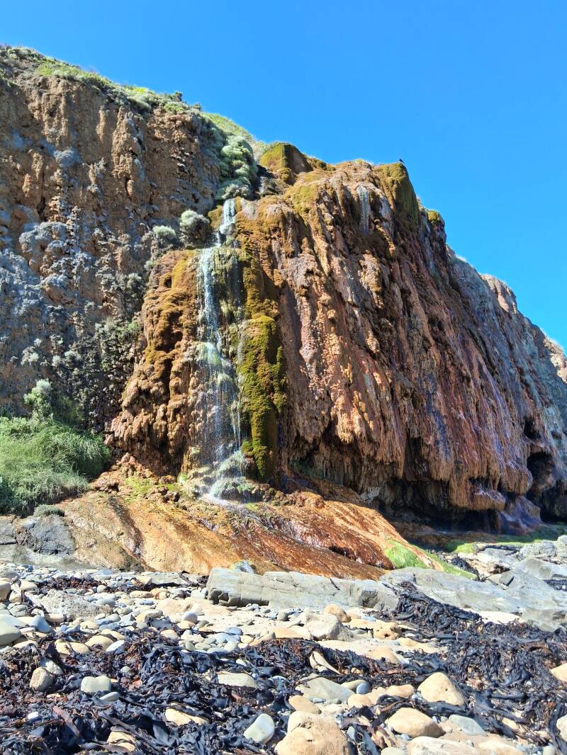
Leaving the Cape Otway hike-in campground for a more or less 10 km hike, you pass the tombstones of the old Lightstation cemetery. The track then meanders towards the wonderful Station Beach. You can choose to walk along Station Beach to see the cliffs from below or take the clifftop trail for ocean views. The latter is the easiest option, but we took the Beach one, physically demanding, with very long parts of soft deep sand in the hottest day of the 8-day hike. Workout and sweat for sure! From station Beach a 1km detour brings you to Rainbow Falls, a freshwater springs cascade that pours water over a rocky stone covered with variants of coloured moss. Depending on the sunlight, you might see rainbows... Check tides before you go, but that is the case for all beachfront areas. After Station Beach you are moving towards Aire River that you can see from far distance. Do not expect a lot of shade today, as you cross low vegetation even on the tops of the cliffs. The Aire River hike-in campground is located uphill. Here you can swim in the cool water of the river, really refreshing. Also you can walk along the river if you are not fed up with hiking. We could see plenty of birds and wallaby's in the area.
Day 5. Aire River to Johanna Beach
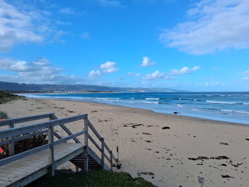
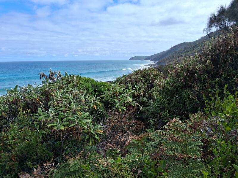
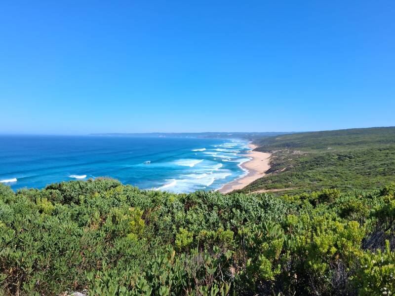
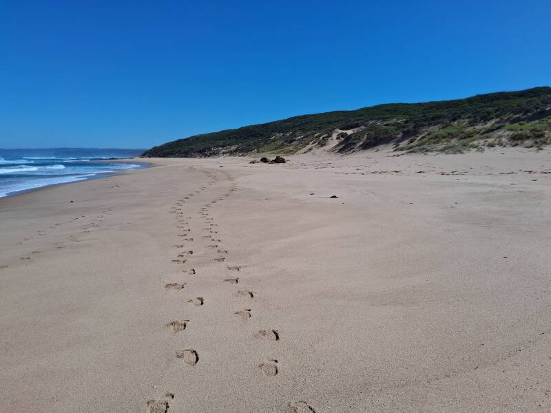
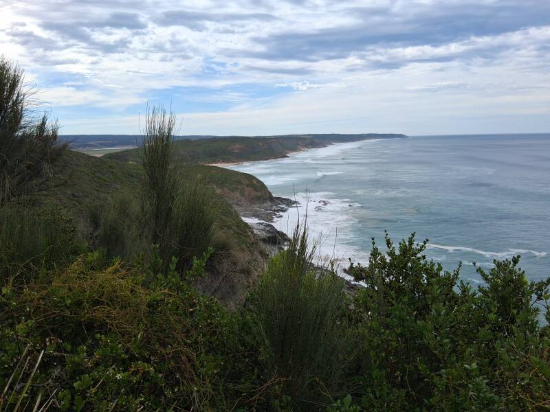
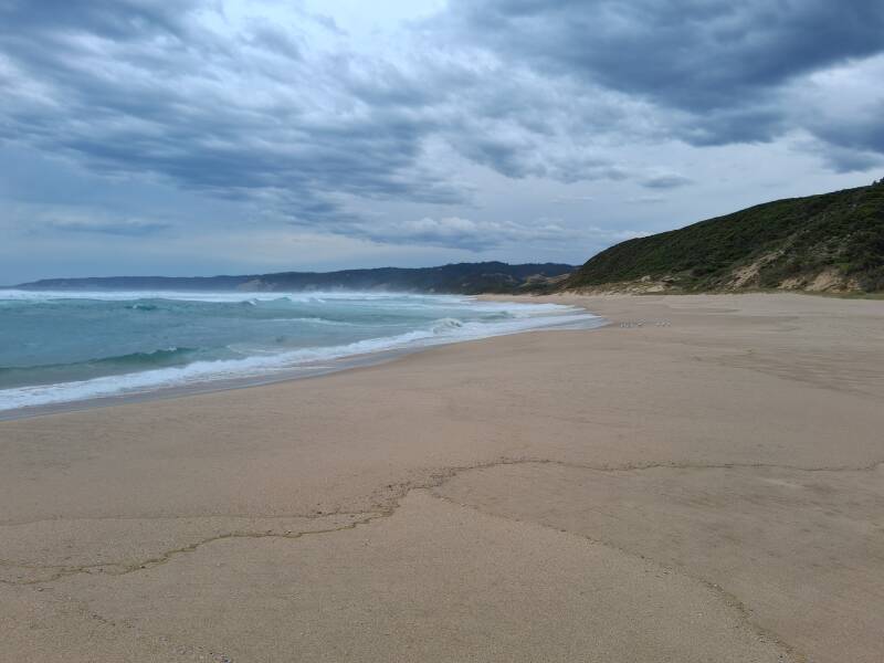
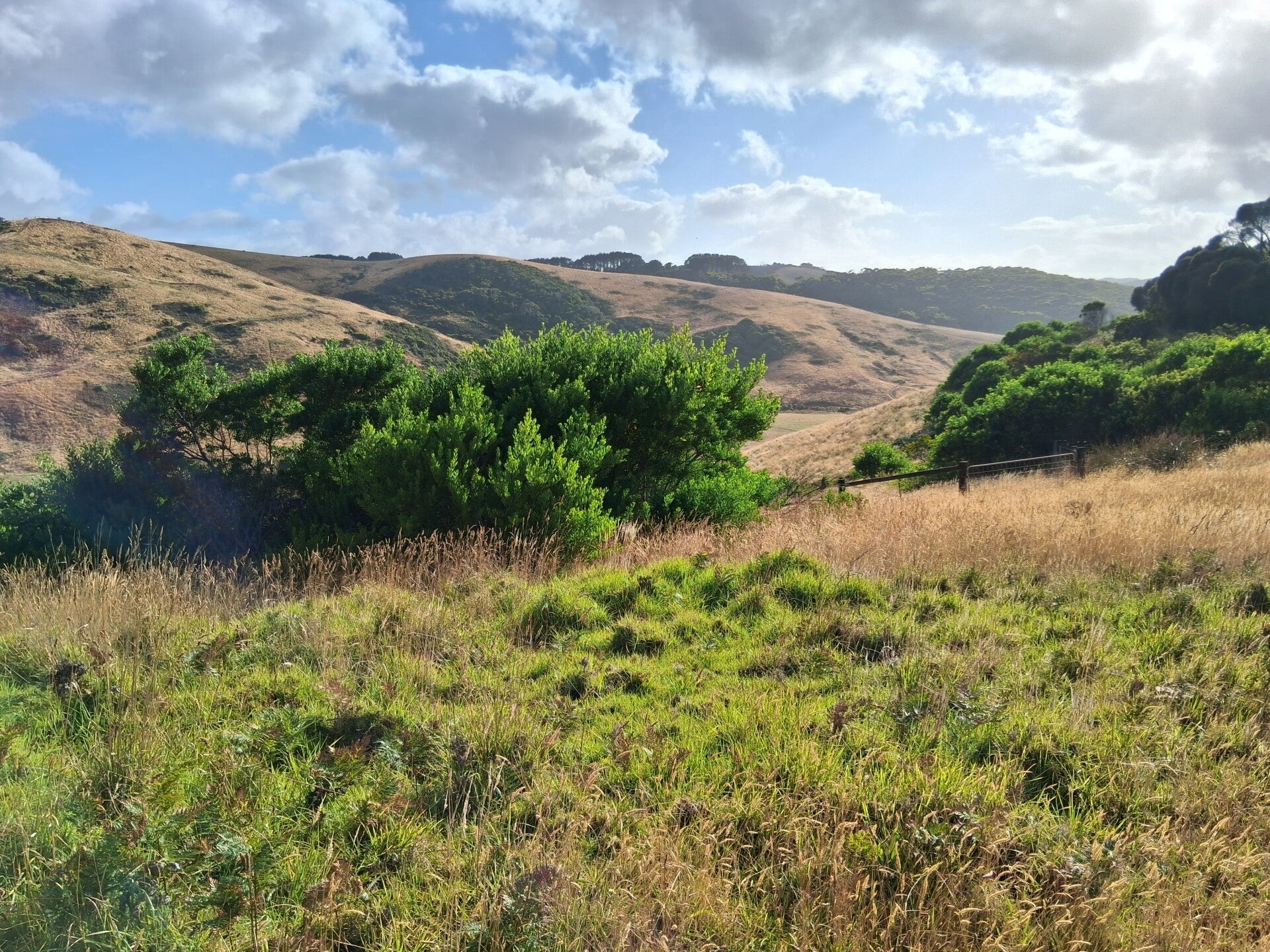
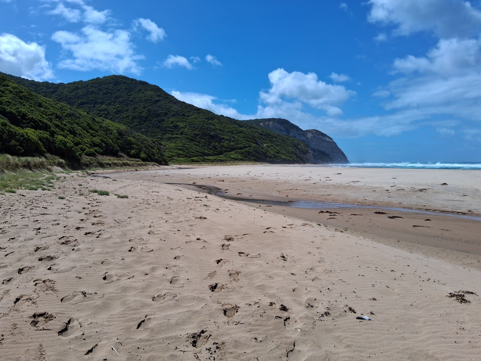
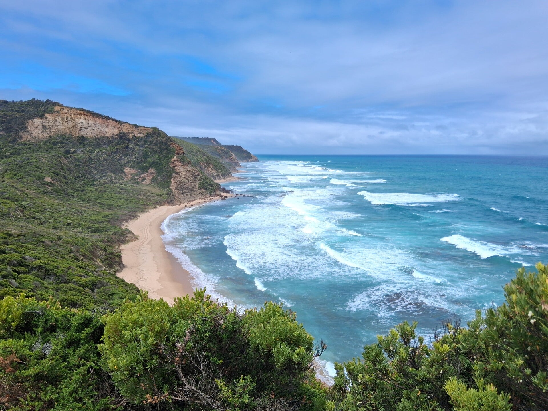
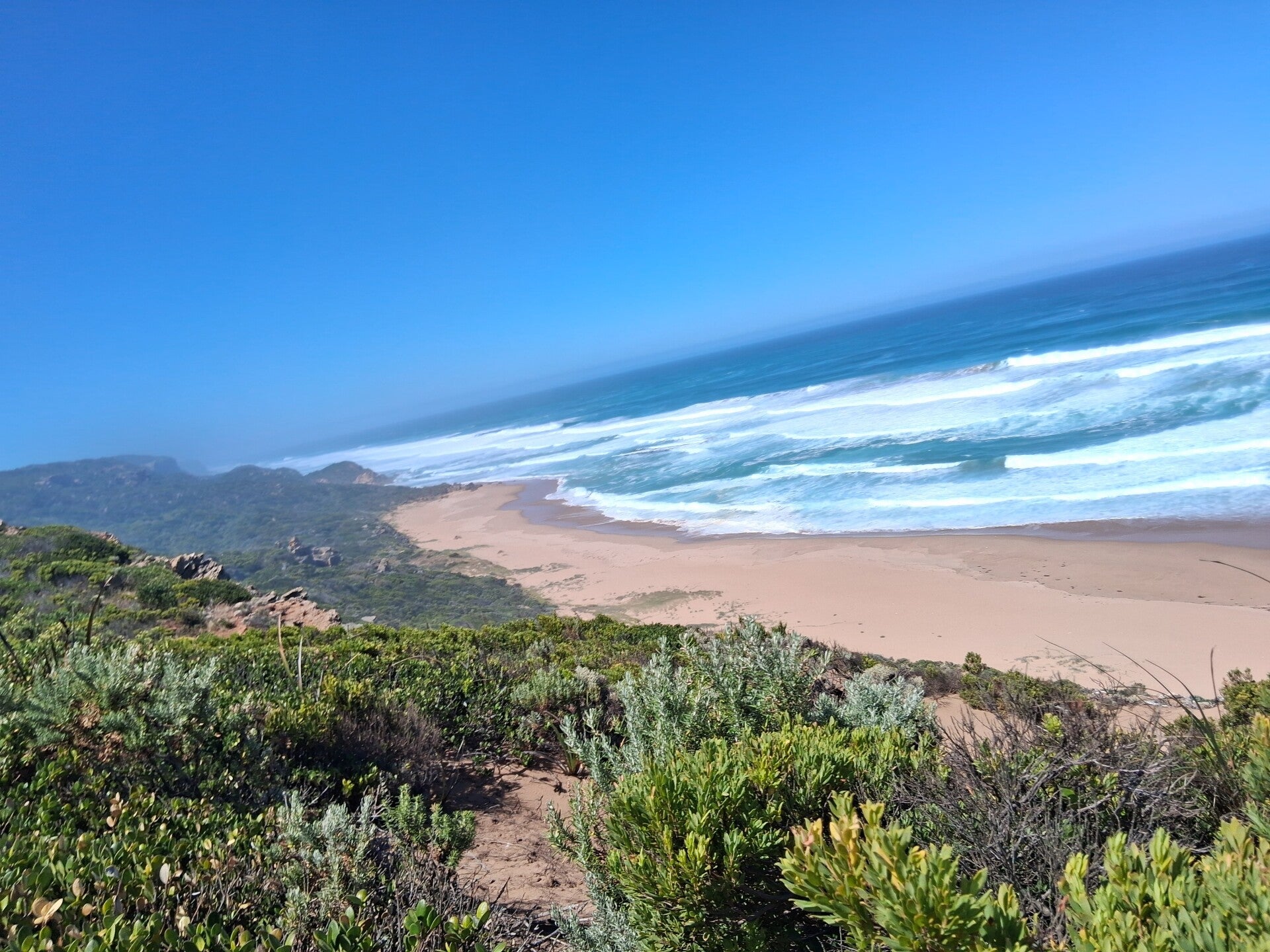
Departing from Aire River, you climb up inland, followed by a decline towards the coastline, that will be your host for the whole day. The hikes become longer from here, today about 14km. Today you will see the rugged coastline, with nice cliffs, rocks, waves, and beaches, and up- and downhill hiking. Amazing views over the ocean … Castle Cove is the first beach you encounter, surrounded by nice cliffs. Form there you pass forest with manna gums, wildflowers and grass trees. The end point of today is Johanna Beach, a very long stretch of sandy beach. We saw the endangered hooded plover here, an inhabitant of the dunes that you should not disturb when breeding. The hike-in campground is on top of the cliffs. Multiple camping spots have a view that Is likely one of the best you will ever encounter on campsites, overlooking the ocean and Johanna Beach. Impossible to describe with text, just go there a bit earlier than the other hikers (if there are, as we only met 2), pick a spot, and enjoy the best-ever dinner, sunset and breakfast.
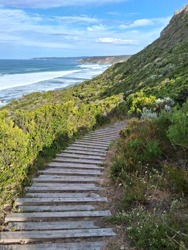
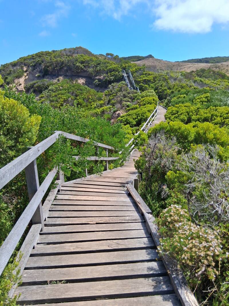
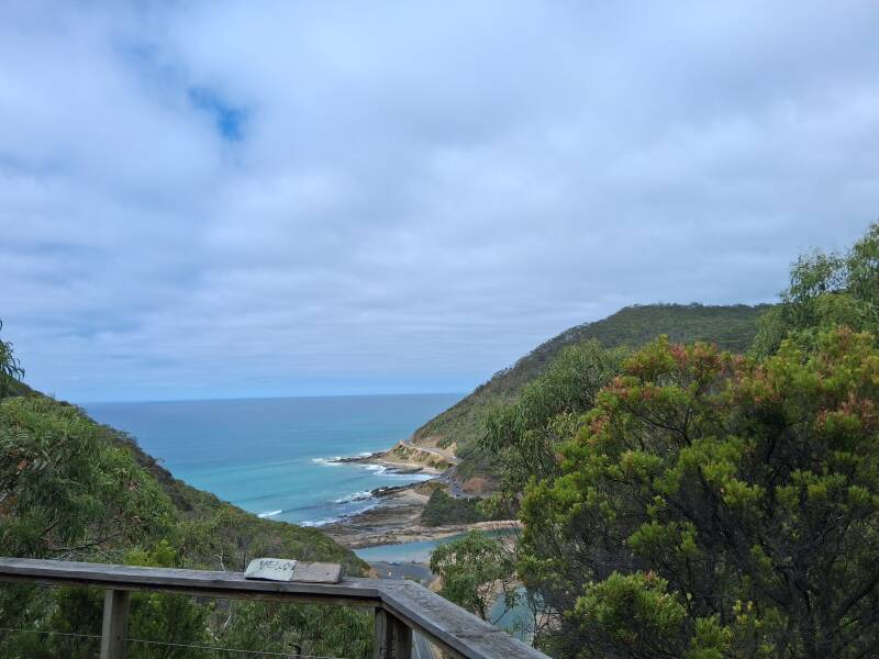
Day 6. Johanna Beach to Ryan's Den
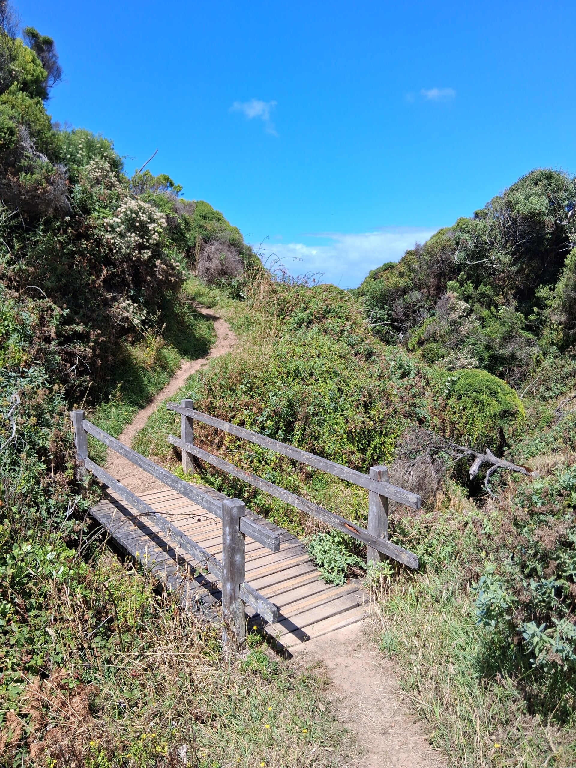
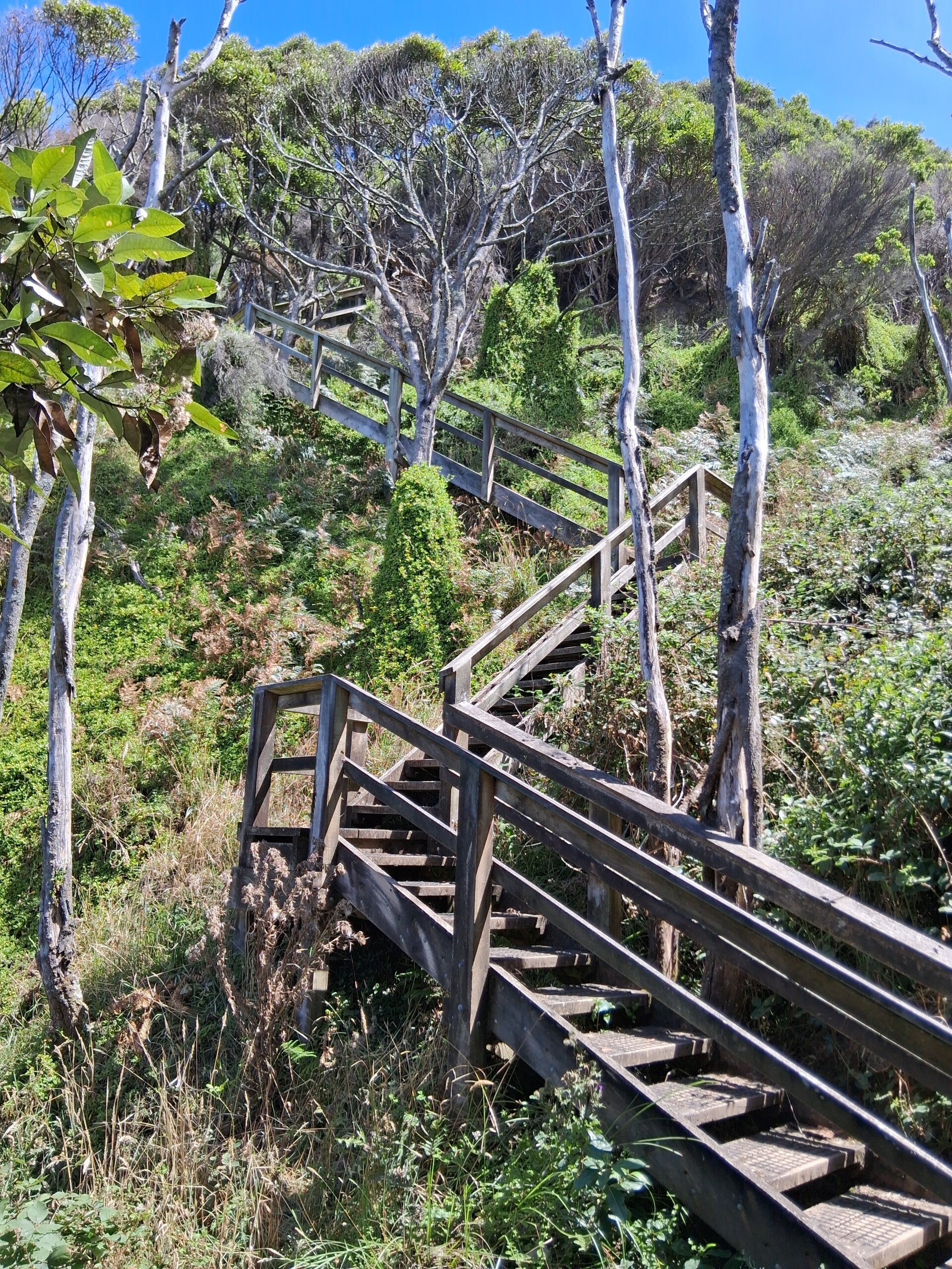
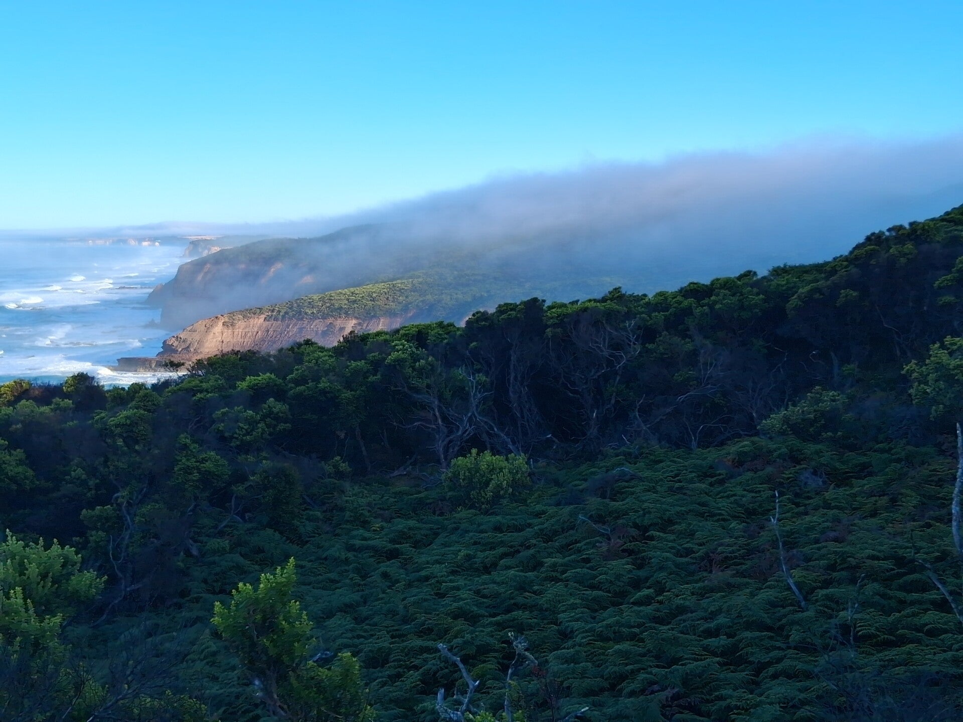
This day has more than 14kms of beauty, initially going some kms inland through farmland and some eucalyptus forest, before reaching the coast at Milanesia Beach, a hidden 2km wide beach that is simply great. After that the track goes up over clifftops to Ryan’s Den. This day it is going up and down, also using wooden platforms and stairs, and as this was a sunny day, it was fabulous. The whole day we did not see anyone, so all places are remote and isolated. Great! Grassland as well, so expect kangaroos. Also a variety of parrots. Not a lot of text for this track, but it is amazing, so pictures tell more than words. Ryan's Den campground ... Waauw. Be early and take a site on the end, and you can see the most amazing view ever (again) ...
Day 7. Ryan's Den to Devil's Kitchen
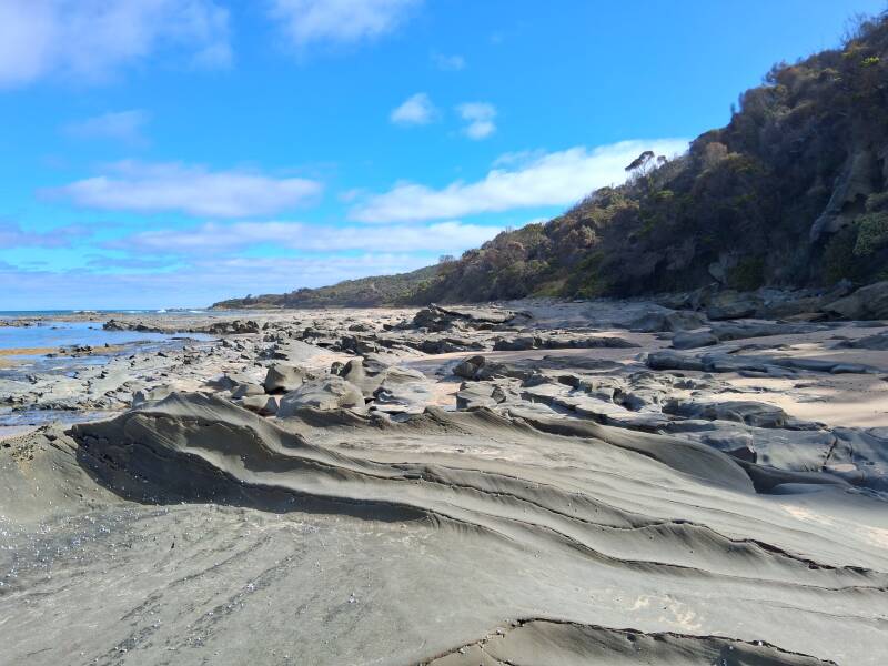
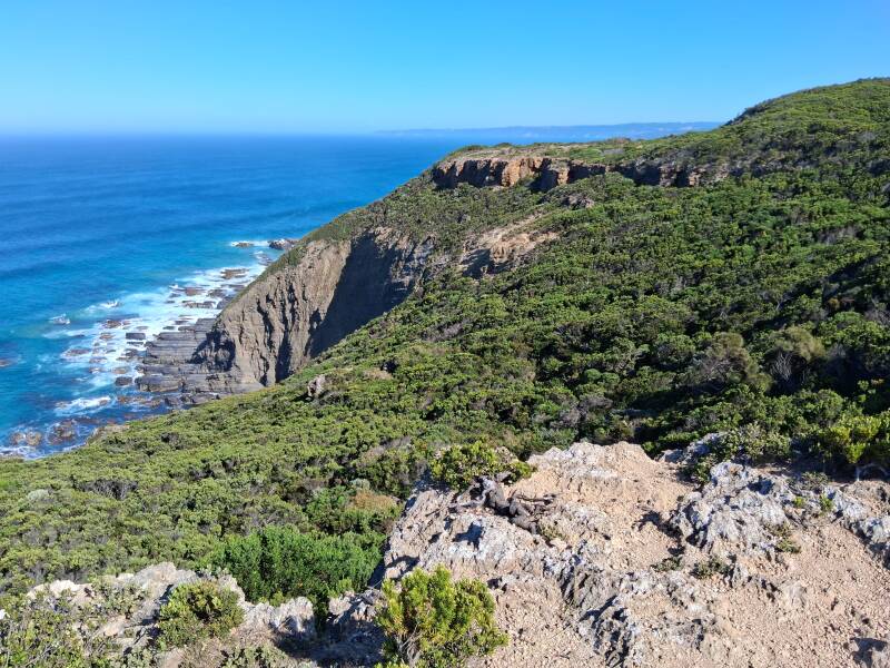
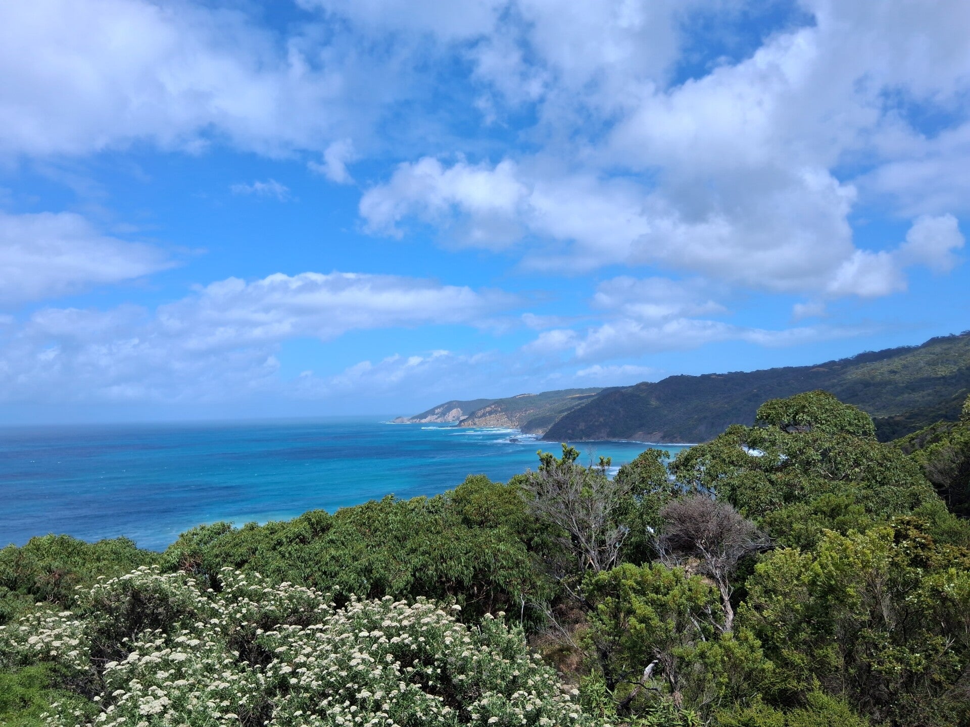
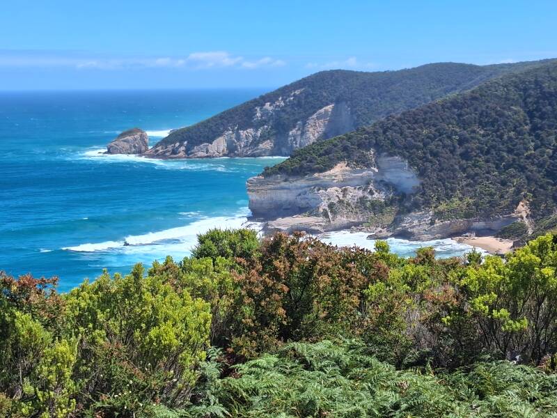
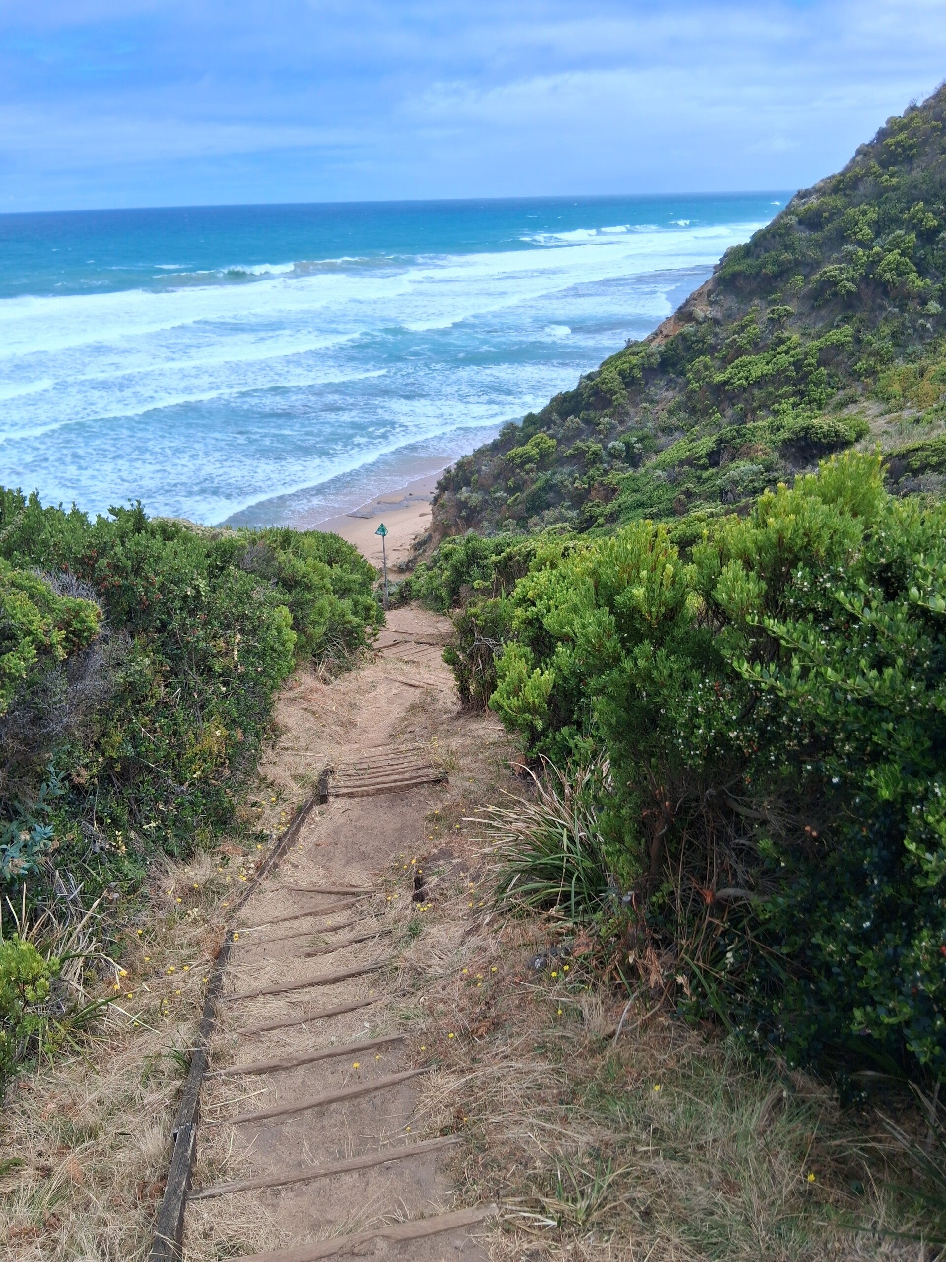
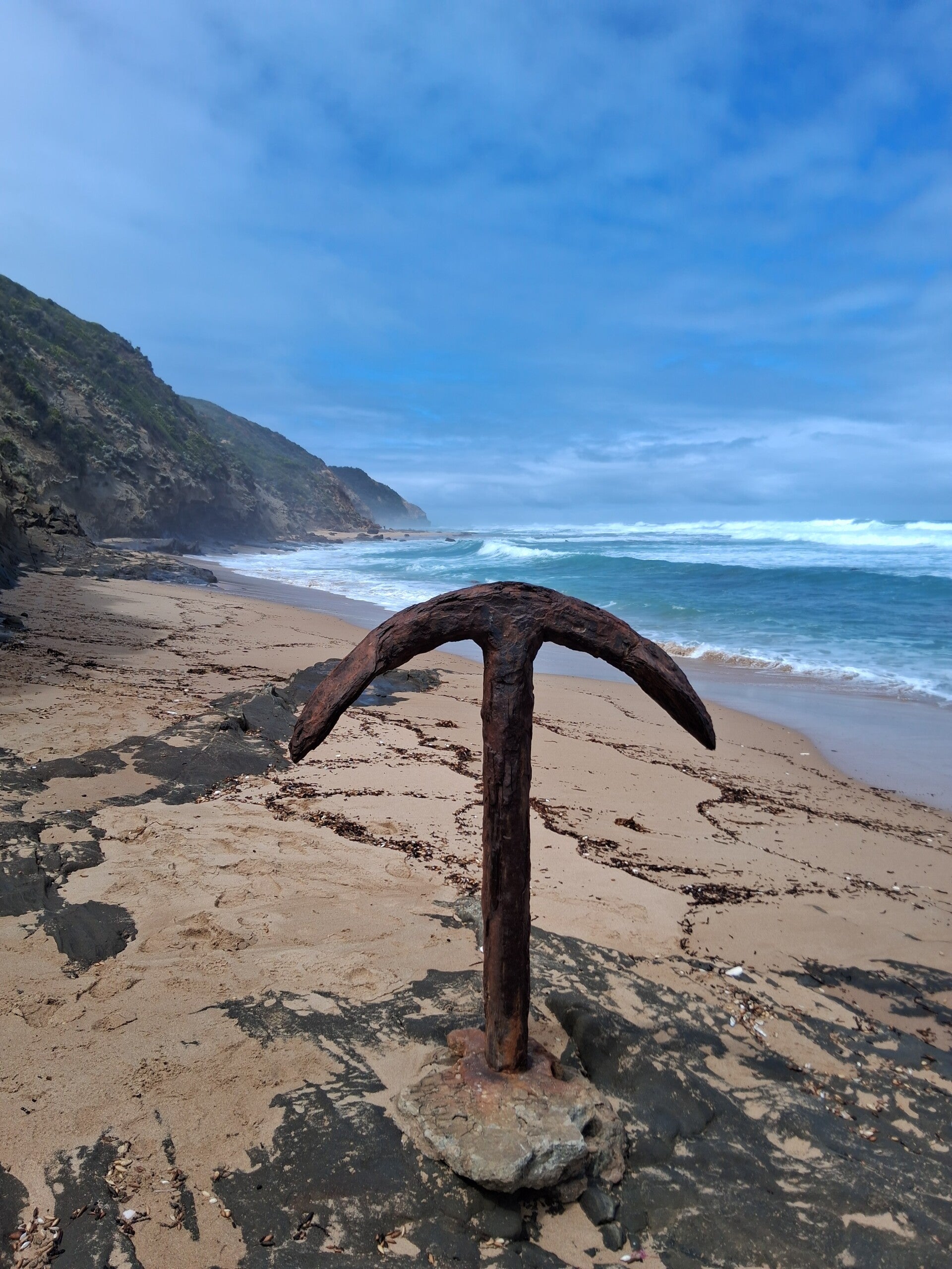
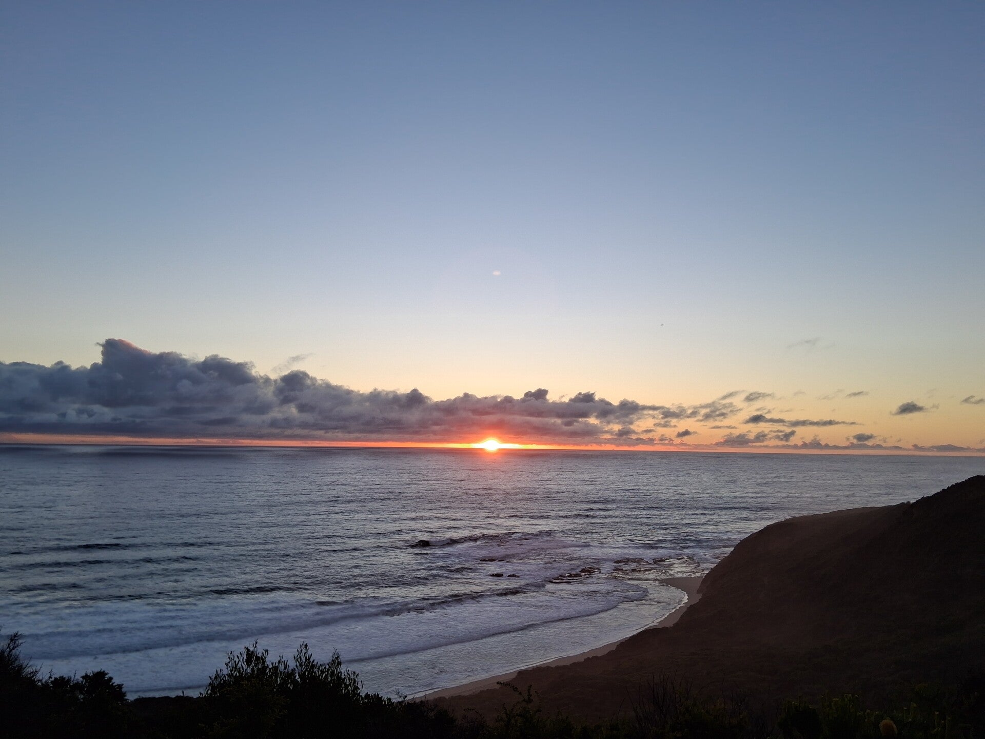
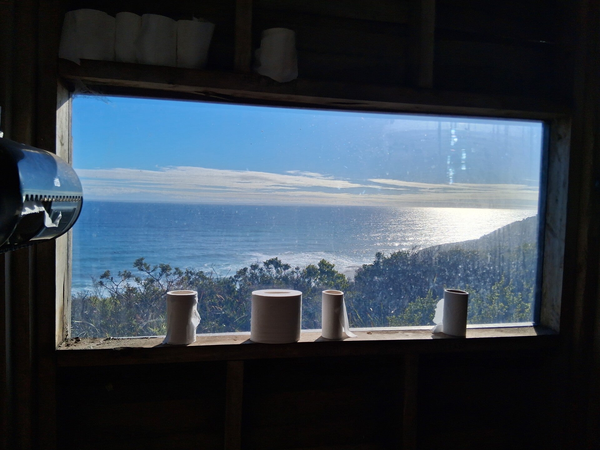
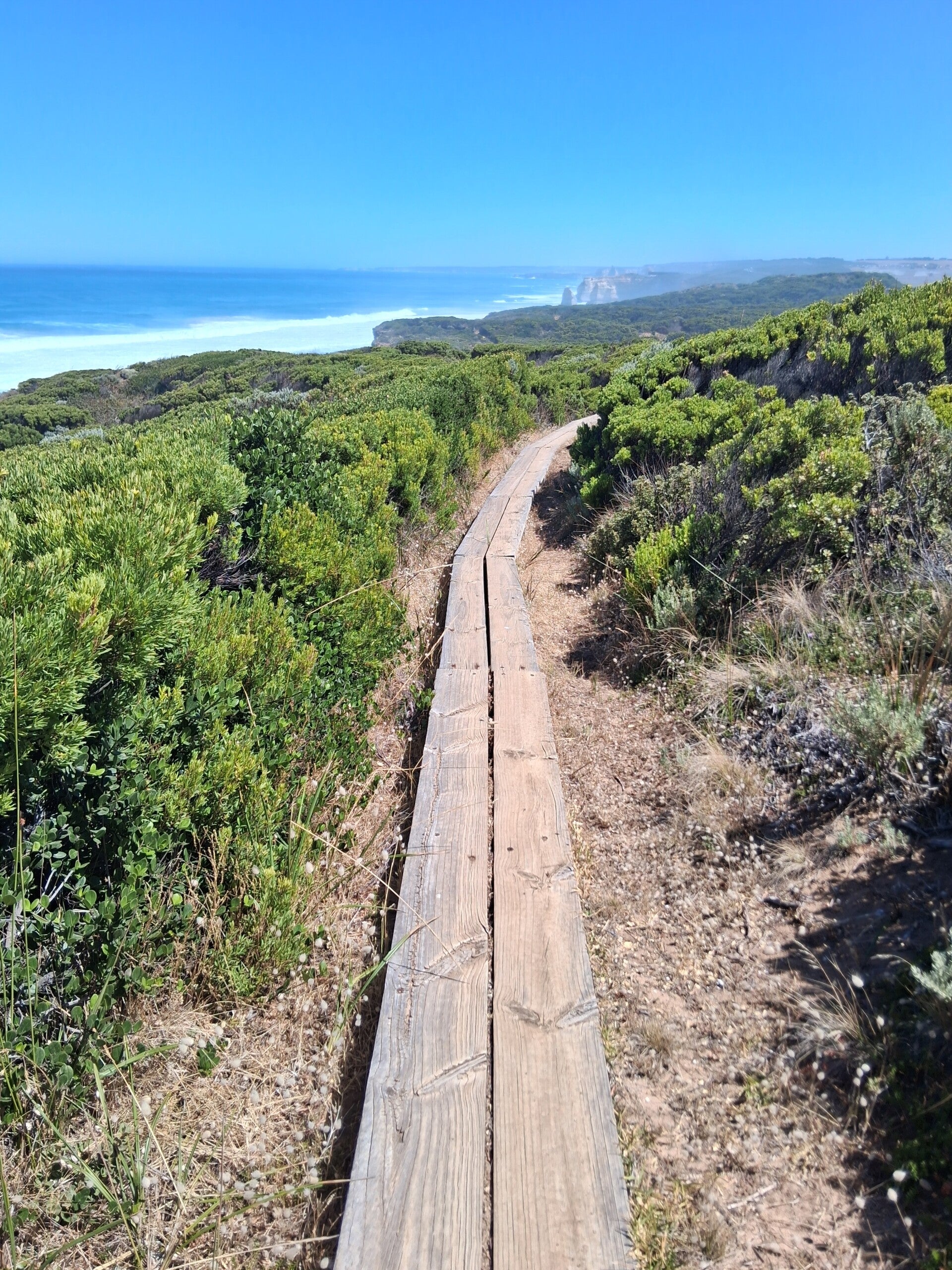
Today we walked about 14.5 kms and again this section was superb, with nice clifftop views and hikes through coastal forest, passing moonlight head, a clifftop view location, and Gables Lookout, idem. You arrive at Wreck Beach and here you can choose the beach walk (look at tides!) or the clifftop walk to the hike-in campsite. We took the Beach option, but had to run at some sections to not be hit by waves … so be careful as the water can rise rapidly. You can see some anchors and other parts of shipwrecks, so it is worth it! Devil’s Kitchen campground is again a fascinating place so try to be there first to choose a perfect spot (the top one is superb, as you have a bank where you can look at sunset), and … go to the toilet! Never had a better view from the restroom! So again a short text, so the picture tell it all.
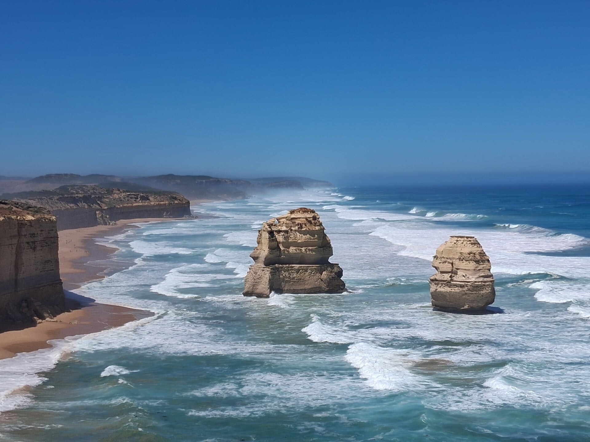
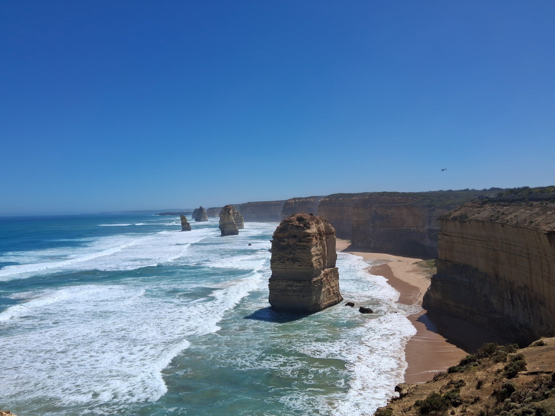
Day 8. From Devil's Kitchen to 12 Apostles
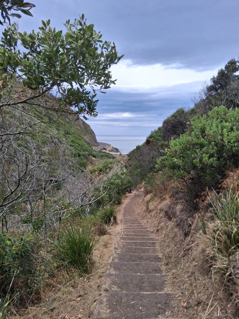
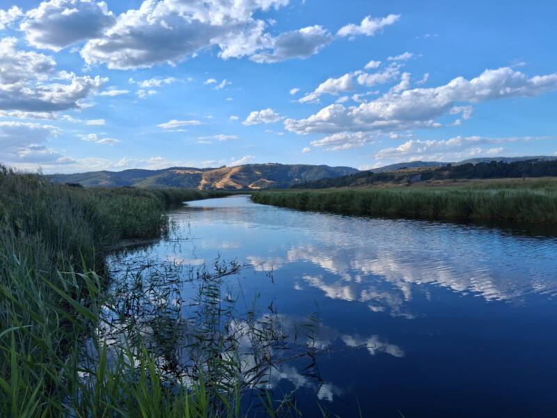
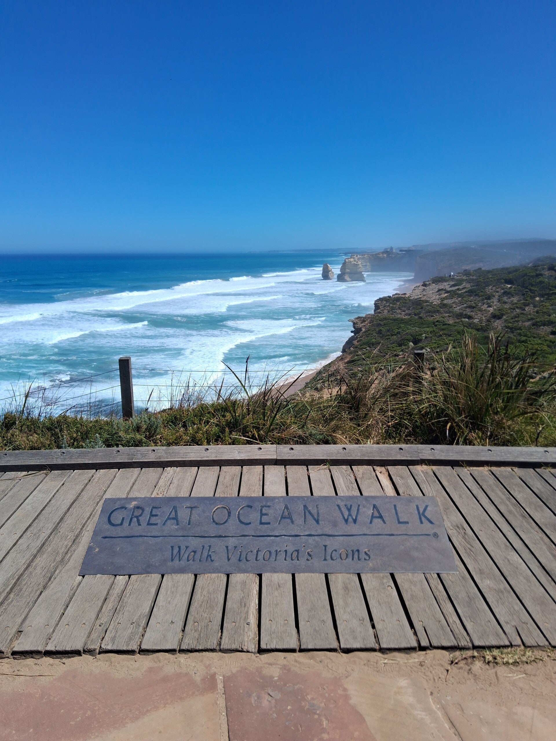
Again this walk (abur 18kms) follows a trail that follows the coastal cliffs the whole day. Halfway you will reach Gellibrand River that you cross over a bridge, and if you are up for coffee and a snack you can go right over a wooden track to reach Princetown (just 500 meters), a small village (the only on the whole great ocean walk) that has a coffee house (also a restaurant and shop but these were under construction works when we did the hike). After Princetown, you walk over the clifftops and you start seeing the 12 apostles, a collection of limestone sacks in the sea, from far away. The symbolic end of the walk is the Great Ocean Walk viewing platform that is intended for people that did the 110 km hike. From this point on we were sure that doing this lonely hiking holiday, with only nature surroundings us, was the best choice. On the viewing platform dozens of people were queing up that off course came from the Apostles Visitor Centre by bus. So you arrive soaked in sweat and see buses of tourists everywhere, so a mass crowd also at the Gibson Steps, that you can descend to see the Apostles from below. We also went to the 12 Apostles viewing point and this looks great, but we especially wanted to get rid of this place as fast as we could. Ice cream was the good news here. We became used to silence, nature, animals ... welcome back! We had a pick-up arranged to bring us to Lorne, to relax and rest after this long hike.
Lorne
After hiking the Great Ocean Walk, we decided to have a 2-day stay in Lorne to rest and relax. That failed, as this place is not only a pleasant and vibrant town full of good restaurants but also an area with plenty of waterfalls and scenic hiking trails. While you can off course use apps to download walking trails, we just followed our nose using Google maps. Plenty of choices and trails that connect with each other, so easy to make loops of any distance. When we were here, the area had been hit by floodings and multiple tracks were closed, including the ones to Erskine Falls.
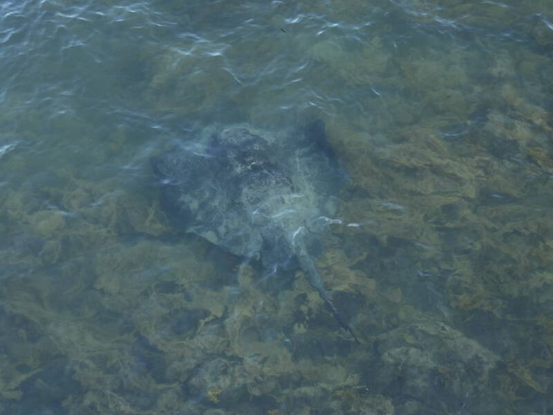
Anyhow, we stayed at the Queen’s Park Caravan Park in a Safari tent, having a terrace overlooking the ocean. From here, some trails start and we went to Teddy’s Lookout the first day, a relatively short walk to a viewpoint. The center of the village is really nice. Lorne Hotel is a great place to dine and have a drink, on a first floor terrace hosting cockatoos, trying to steal your food. Also live music very often so a really nice atmosphere. Walking along the shoreline you can walk up the pier. Look down in the water. We could spot a huge stingray here. We strolled through the village and also went north along the beach towards Stony Creek Walk, that meanders through a park to Waterlily Pond. This is just a place to relax, sit on a bank and at the end there is a small pond and a river (that was dry when we were there).
The second day of our stay here we hiked some trails and even did close to 18kms. This area is superb and you can even stay here for multiple days as the there are so many nice viewpoints, waterfalls and hiking trails that need much more time to see it all. Erskine Falls on the North, likely the biggest in this area, was closed because of the floodings so we just took Google Maps and started heading South, without any clear direction in our minds. We thus took the Tramway track walk, then Ocean Walk and took the direction to Allenvale Road, a spot named Wil’s Dam Walk on Google maps. There we crossed the road and, based on the advice of some locals, took Green Break Track and then left the Henderson Track, arriving at Allen Dam, where Lorne’s drinking water is derived from. A few hundred meters before Allen Dam, we crossed Cora Lynn Creek and trails. Here we could see the immense damage caused by the floods, which must have carved the small river into a gigantic waterway that swept away all the trees and reduced the walking paths to mud. Inaccessible and an immense task to restore. We kept on following Henderson Track to The Canyon, with giant moss-covered boulders and even a small tunnel in the rocks. Beautiful part with dense forest. At a certain part of the Henderson Track you can take a short walk to Henderson Falls, but this zone was completely ruined by the floods so we did not go there. Won Wondah Falls we passed and from there we went to Sheoak PicNic Area. This place can be reached by car but at this time there was no-one. Then, if you look at Google maps, we took some kind of track (with no name) that goes parallel with Garvey Track (which is basically more or less a road) initially but goes very steep up to reach Sheoak Track. From there we went to Castle Rock. To our view, this is not really a place you need to see, as the viewpoint also overlooks a camping and it is a long back and forth detour. From here we went to Sheoak Falls, that can be reached from the Sheoak PicNic area off course, what we did not do, but we would suggest to take that trail, because Castle Rock is less attractive. Nice area as well. Not too much water in the river and Falls, but worth the hike. From there we went to Great Ocean Road and hitchhiked back to Lorne.