Borneo (Malaysia)
Borneo is a huge island that is shared by Indonesia (the South, the biggest part, Kalimantan), the very small nation of Brunei (in the North) and the Malaysian provinces of Sabah (North West) and Sarawak (North East). The island is known for the amazing rainforest, beautiful beaches and many wildlife present! Seen the limited time we had, we only visited some of the most beautiful hiking spots and wildlife destinations in Malaysian Borneo, but there is much more to explore . We arrived at Kuching (Sabah) and choose some spots there and excluded others, as we only had 4 days in the Kuching area. Also the Kuching Wetlands, a mangrove area with Irrawaddy dolphins, are nice to visit, but we did not have enough time to go there. We further spend 4 days in the Eastern province of Sarawak, visiting Deramakot National Park and Kinabatangan River, both wildlife paradises.
Mount Santubong
The region around Kuching has nice hiking trails, but be aware that most only permit people to start hiking before 9.00 or 10.00, and trails close around 16.00 to prevent walking in the dark, so do not start too late (as we more or less did)... Anyhow, from the headquarter or the ranger station (reached with taxi from Kuching in 30 minutes) you can take the route to the Summit, which starts rather easy, passing a waterfall, but ends up with one of the most adventurous hikes you will ever walk on. Guided with ropes and ladders, this is a hike that goes vertical ... It passes trough the rainforest and can be slippery from time to time, and you need quite a good health condition to reach the top. We did it in about 4 hours but be aware that some people need more hours. No taxi service to go back but you can ask the rangers to open wifi and you can take a ‘Grab’ service back. There is also a blue pool close to a resort but time did not permit us to follow the loop trail. We just went up and down. Going down, halfway you can follow an ‘emergency trail’ straight to the main road if needed. Maps are given at the HQ or ranger site and you can find them online as well.

Figure. Last part of the hike to Mount Santubong. Note the very steep parts, in which you need to pull up by the rope while putting feet on tree roots, and on top use ladders.

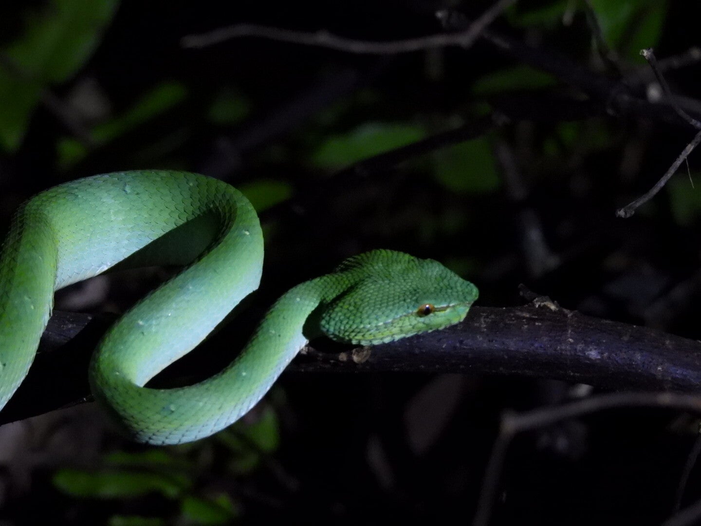
Figure. Hike to the Mount Santubong Summit Trail, passing over a river with rocks to use for crossing.
Kubah National Park
Kubah is only 20 km from Kuching, so easy to reach by taxi. Also here, the start of the trial needs to be early to be permitted. The park is mountainous and contains rainforest and inlcued 3 peaks, of which we tried the Gunung Serapi. Multiple trails are present and all info and a map is available at the headquarter (or online). The Summit trail is steep and follows a concrete path to the top of the Gunung Serapi and although the view is great, the way towards could be more attractive. The waterfall route is in the dense wood and is more attractive. We did not perform the Rayu trail that ends of Matang Wildlife Centre. Also here you can do night walks to spot frogs and snakes so book these upfront.


Bako National Park
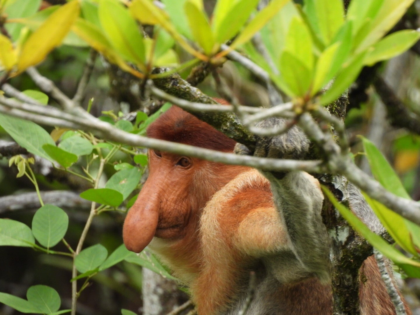
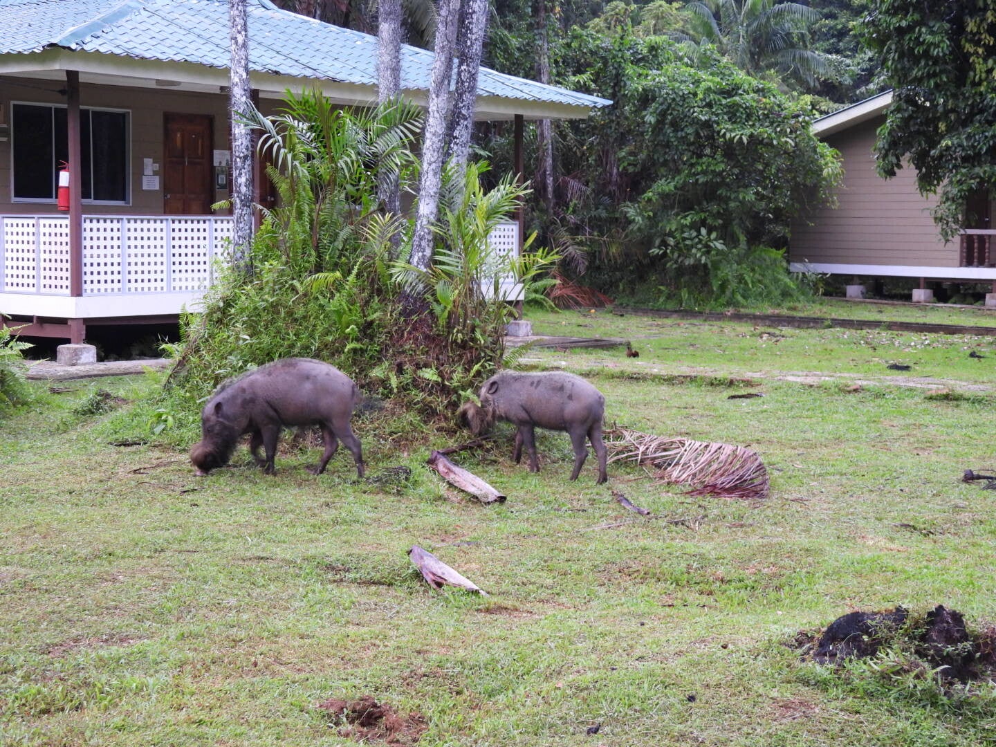
This park is the beauty of the Kuching area! You will need to take a boat at Bako village to reach the National Park Headquarters, and register there for any walk you do. There are some basic place to sleep around the HQ. Do not expect luxury and the rooms do not have airco so expect a hot, wet and sweaty time, but it is worth it. The food is good. Pre-booking a room is essential. Also, you are depending on tides to reach the park, so check well beforehand or book a tour. We booked a tour so a guide arranged all transport, but we did all hikes at ourselves. Simply ask the guide. The guide however was essential to do some nice night tours to spot spiders, snakes and frogs. A map is available at the HQ and the trails are well marked. Only disadvantage was that at the time we visited the park, many were closed due to maintenance so better also inform well before going. Anyhow, this is the place to go in this region for beautiful walks through rainforest ending at remote beaches and viewpoints, while spotting some typical animals, including Proboscis monkeys (and others). Wild boars are welcoming you at the park HQs. All trails with lengths and durations can be found here: https://www.etawau.com/Geography/Sarawak/01_Kuching/District_Kuching/Kuching/PlacesToGo/Parks/BakoNationalPark.htm.
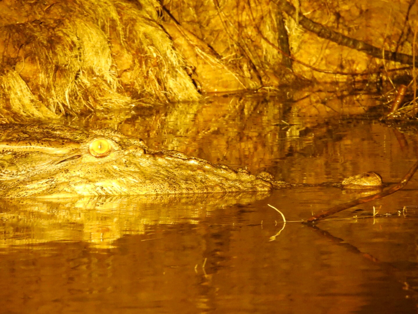
While you will need multiple days to do all trails (especially the ones that are going to the eastern part of the park), we thus picked the ones that were accessible, being the Telok Pandan Kecil (beach) and Besar (nice rock above the sea), and the Tanjung Rhu (nice rocky area at the sea), and also the Tajor Waterfall and Tajor Beach. The waterfall is not impressive but the hikes are great and the beach (quite a distance through sweaty hot conditions over rough slippery rocky paths with a lot of roots) is beautiful. When we arrived there, there was no one except dozens of monkeys. An amazing place with hundreds of meters of sandy beach. On all beaches, be aware that there is always a risk for crocodiles in the water. We stepped in the water and even a bit further but be aware. We saw some on the way back so there are there... Also be aware of monkeys as 1 of them was trying to catch a rucksack so be cautious. They come while you do not expect them.


Deramakot National Park
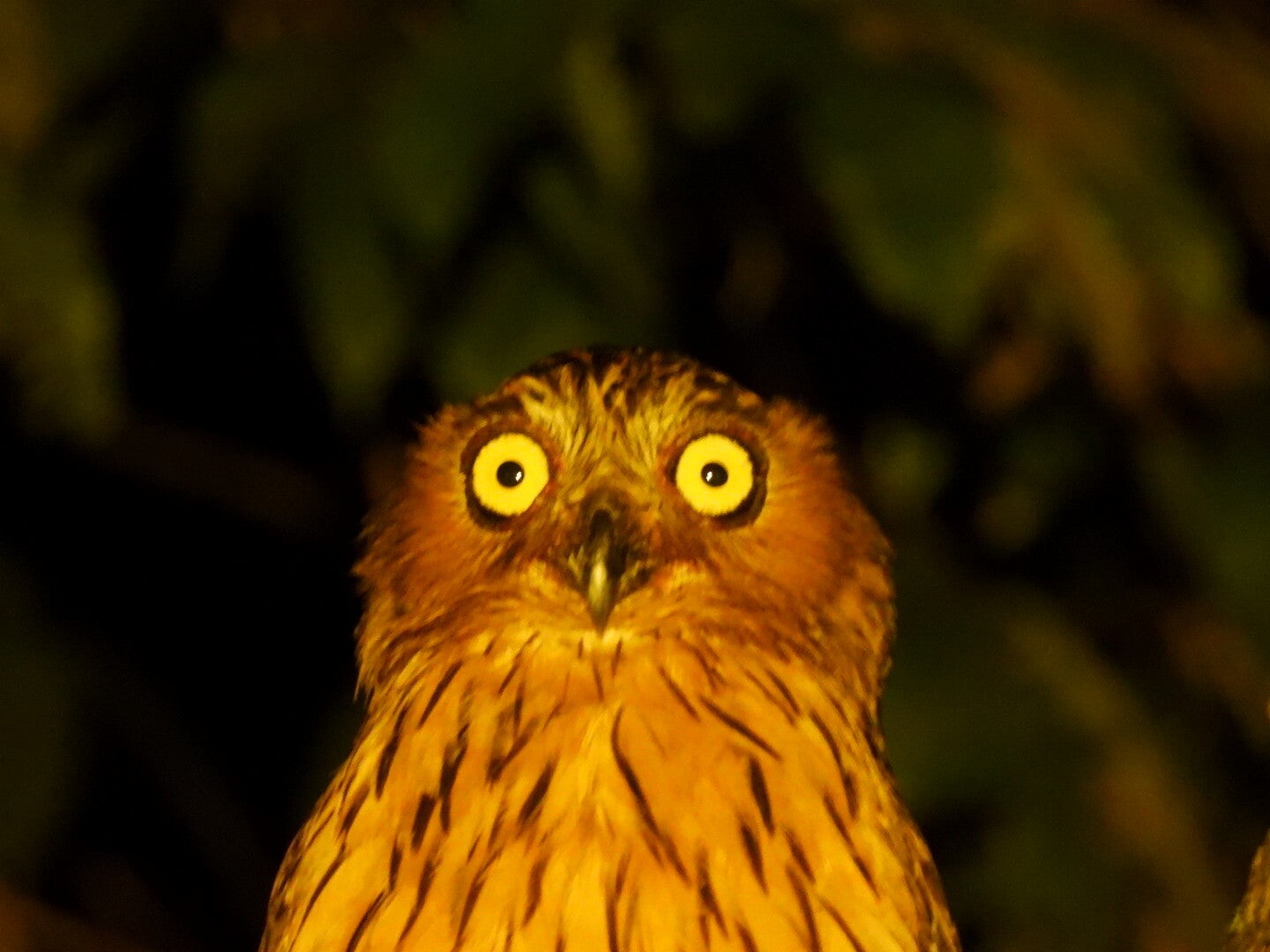
If you want to be in the tropical rainforest, Deramakot is one of the places to go, located in Sabah, so Eastern part of Malaysian Borneo. The place is known for its wildlife, including orang outangs. It is very remote, so take into account hours of bumpy driving from either Sandakan or even Kota Kinabalu. In the park, there are guided 4x4 safaris and night drives (book before hand, we had Lost Borneo Tours and they were good), and there is basic (but airco!) accommodation and food. The park is reached from Telupid and the drive from there takes you through palm plantations (they look nice and you drive through these for more than 1 hour to reach the National Park, after which you need more than 1 hour to reach the HQ, at least). So ... the place is remote! There is in fact only 1 main jungle road crossing the park. This means that all tours go through this road and seen the enormous area of this national park, the chance of seeing wild animals is less than in place such as Kinabatangan (see below). This being said, we stayed 2 nights in the park, and did multiple guided 4x4 safari’s, including a night safari, and could spot the orang outang, gibbons, many birds, flying foxes, civet cats and many more. Disadvantage is off course that the animals are sometimes a bit further off the road, so binoculars or nice zoom are essential. Off course here you need patience and sometimes is might become boring when not seeing any animals after driving for 45 minutes. There is a hiking trail close to the HQ (going left when leaving the HQ and the left in the rainforest) but also here were maintenance works ... so we turned back halfway. Anyway, what was clear here is that Borneo has a huge rainforest and wild animals have space...


Kinabatangan River
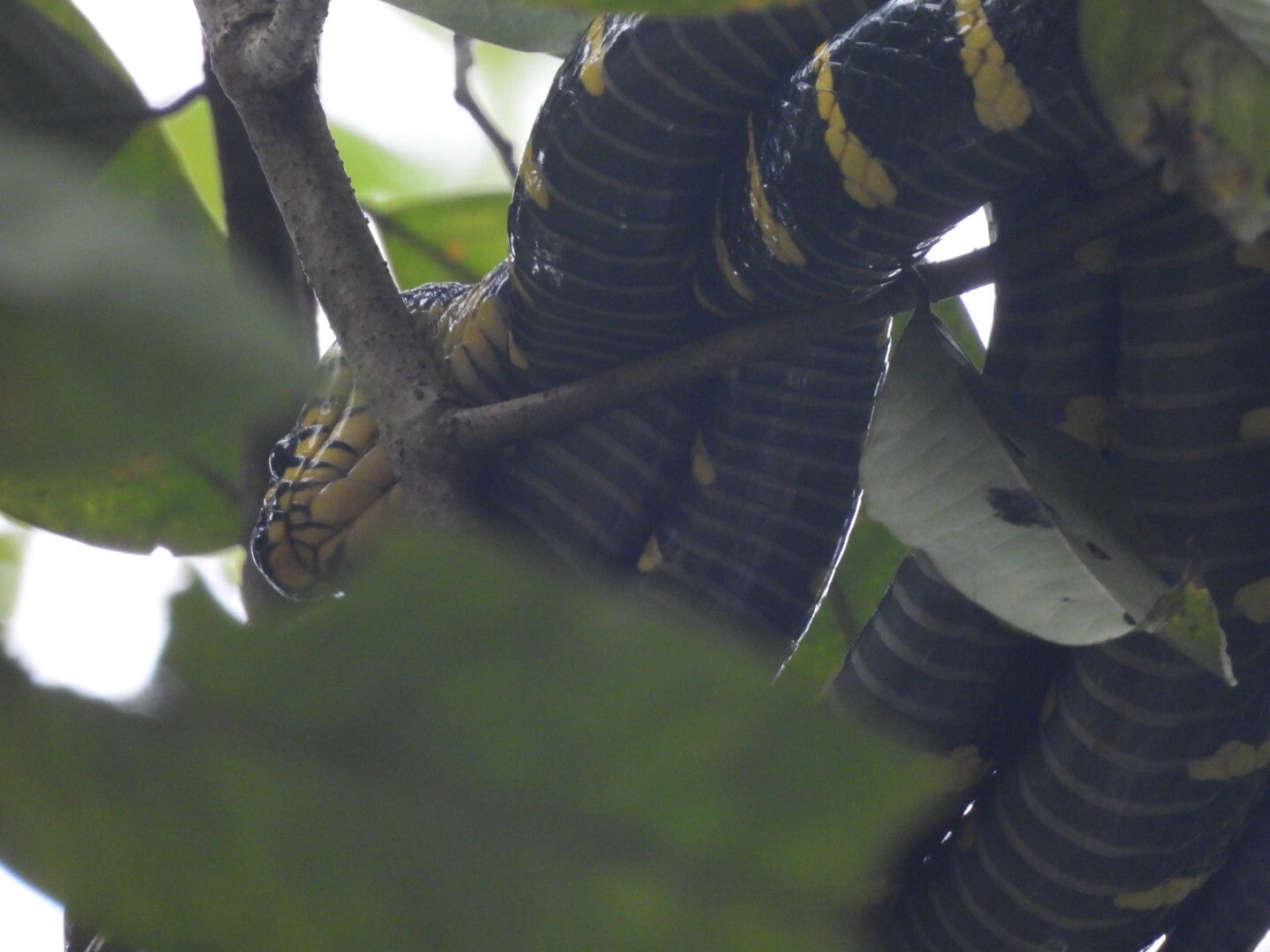
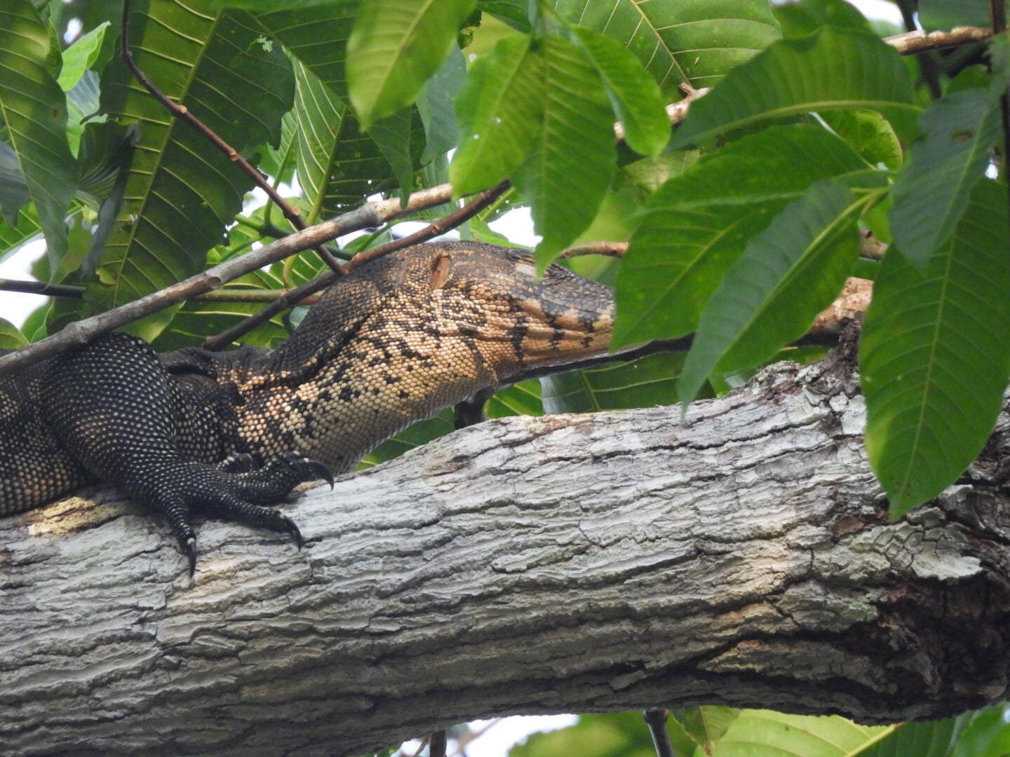
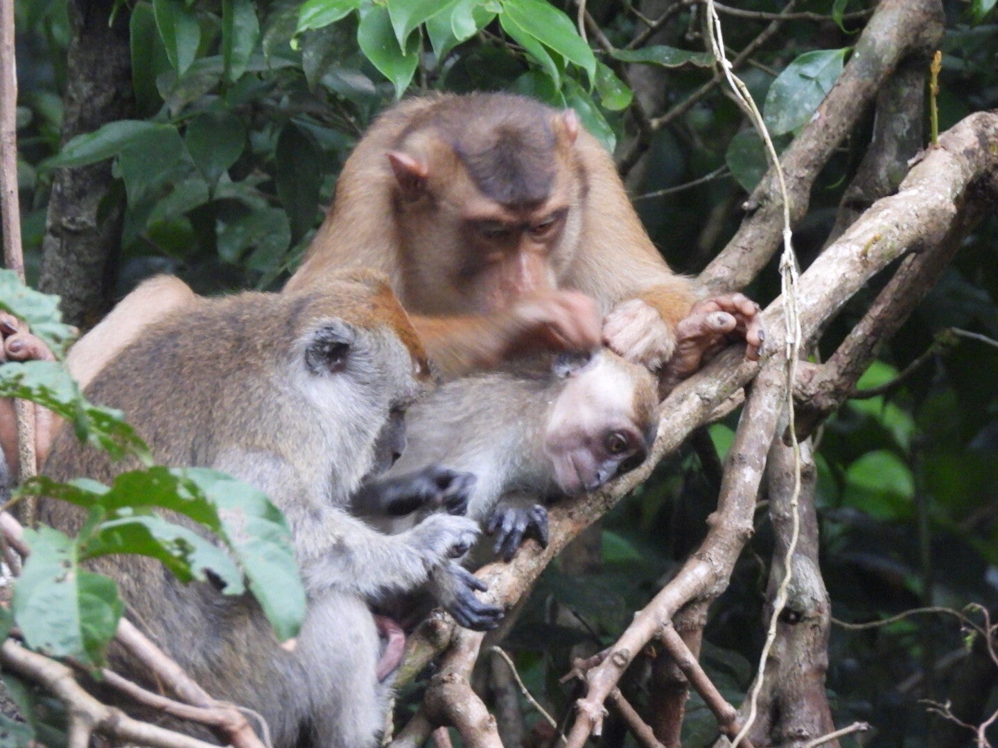
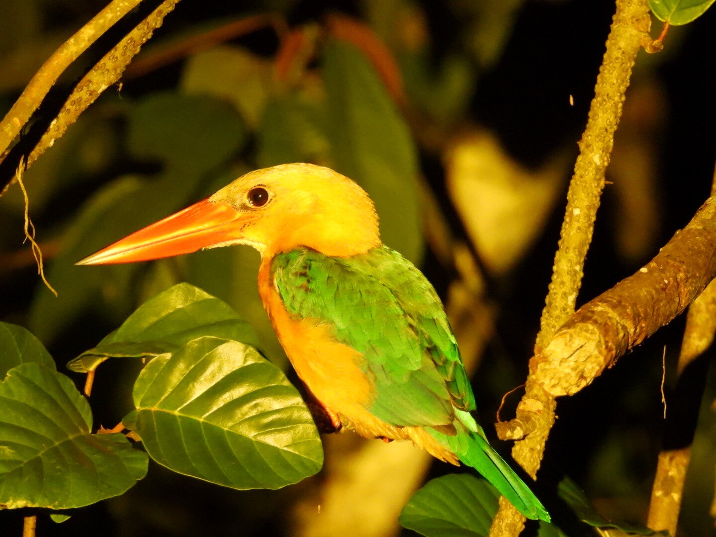
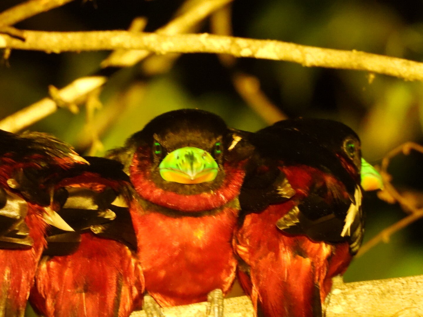
This river is about 560 km long and is home to a huge variety of animals in the rainforest that accompanies the river. We stayed in Sukau and did multiple boat tours, also early morning and at night and yes ... if you want to see wild animals of any kind and you do not have plenty of time, this is the place where you need to go! The river is broad but there are many side arms and animals are really spotted every few minutes if your guide is good (they contact each other during the trips when animals are seen). So ... pigmy elephants, proboscis monkeys (eeuh... hundreds), all kinds of other monkeys, slow loris (extremely uncommon, our guide was amazed), snakes, crocodiles, off course the hornbills, and yes... orang outangs. So a wildlife paradise, this is a must in Borneo! Again here Lost Borneo Tours was our guide, and the accommodation was basic but good, food well prepared. We did 1 hike ... in Sukau village if you go Tomanggong Limestone Area, which is basically going to the end of the village (the last house, on Google Maps it is the Keruak Caves Trail), you will find a trail rail has been carved out by local Pygmy elephants (with muddy prints of the feet). Not easy to find, but after the initial 100 meter, you step over a wooden bridge over a small creek, and from then it is nicely indicated (it passes the Keruak Forest-Based Recreation Center indicated in Google Maps (just a wooden chalet), and a wooden watchtower). Prepare for mud and water on the trail but at the and you find a nice big cave with bats, in the hills. Takes 2 hours to complete.